What is recorded here
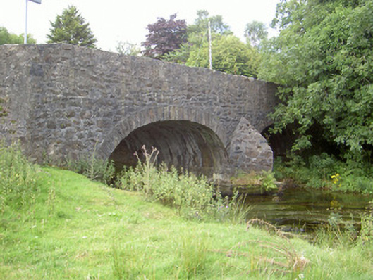
Curralhir Bridge in Drumnacarra sticks pointed stone elbows into the Flurry River and divides it between two arches. Even a river can't get through Ravensdale without being told, 'There's another queue over there.'
Double-arch road-over-river bridge, built c. 1780. Random rubble stone walling to spandrels and parapet, roughly dressed stone coping to parapet, random rubble stone V-cutwaters to north and south. Roughly dress stone voussoirs to arches. Bitmac roadway travelling east-west carrying roadway over Flurry River, random rubble stone wall running to east protecting road from flood plain.
Curralhir Bridge, crossing the Flurry River, is an attractive bridge of traditional construction and forms an important component of the riverscape. The V-cutwaters, roughly dressed stone voussoirs and parapet and the long random rubble walling running to the east, protecting the road from the Flurry River flood plain, all add to the architectural detailing of the bridge which retains its original profile and form and is of a technical engineering interest.
From the Buildings of Ireland (National Inventory of Architectural Heritage) record 13900421
This does not grant access. Most recorded buildings are privately owned; view them only from public ground unless the owner allows entry.
Places near here
 Feede MountainMountain / peak · 972 yd
 Megalithic StructurePortal tomb · 1034 yd
 CairnCourt tomb · 1065 yd
 Anaverna HouseGate lodge · 1085 yd
 Ravensdale LoopWalking route · 1321 yd
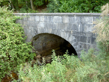 Ravensdale HouseBridge · 1334 yd
 The Ben RockMountain / peak · 1427 yd
 Ravensdale ForestForest · 1.0 mi
 Kilnasaggart Inscribed Pillar Stone & Cemetery with 6 Cross-carved Stones: Cell Na Sacart in EdenappaKilnasaggart Inscribed Pillar Stone & Cemetery with 6 Cross-carved Stones: Cell Na Sacart · 1.3 mi
 1978 British Army Gazelle downingAviation accident · 1.5 mi
 Moyry CastleCastle · 1.5 mi
 Castle & bawn: moyry or moiry castle in CarrickbroadCastle & Bawn: Moyry or Moiry Castle · 1.5 mi
Pictures: Eric Jones, Geograph · CC BY-SA 2.0; Wanfried-Dublin, Wikimedia Commons · CC BY-SA 4.0; Eric Jones, Geograph · Creative Commons Attribution-ShareAlike 2.0; National Inventory of Architectural Heritage; Eric Jones, Wikimedia Commons · CC BY-SA 2.0; JalvinWiki, Wikimedia Commons · CC0; Ryan4314, Wikimedia Commons · Public domain; Chris Andrews, Wikimedia Commons · CC BY-SA 2.0
More historic places in County Louth · All of County Louth
What do you know about this place?