
What is recorded here
From the National Monuments Service (Archaeological Survey of Ireland) record CO072-146
Places near here
Photo credits
- Maker not stated on source page, ru.pinterest.com
- Maker not stated on source page, in.pinterest.com
- Maker not stated on source page, www.pinterest.com
- National Inventory of Architectural Heritage
- Maker not stated on source page, commons.wikimedia.org
- Algirdas at Lithuanian Wikipedia, Wikimedia Commons · Public domain
- Aghabullogue GAA / EchoLive source; photographer not named, www.echolive.ie
- Maker not stated on source page, uk.pinterest.com
- Mike Searle, Wikimedia Commons · CC BY-SA 2.0
- Frabjousone, Wikimedia Commons · CC BY-SA 4.0
 Dolmen (Remains of)Standing stone, pair · 276 yd
Explorer Tom Dolmen (Remains of) in Rooves More is basically two stones hugging each other while one leans over dramatically. One…
 Anomalous stone group in Rooves MoreAnomalous stone group · 362 yd
Explorer Tom Anomalous stone group in Rooves More has two stones touching each other, one upright and one leaning against it.…
 Upper ForestCountry house · 1459 yd
Explorer Tom Upper Forest in Rathonoane is all Corinthian columns and fanlights, dressed up like it’s going to a fancy dinner party…
 Upper ForrestCountry house · 1459 yd
Explorer Tom Upper Forrest is dressed up in classical style but has lost some of its original charm with new windows. I bet it would…
 B. Gd. (Disused), Church (Site of)Church · 1.3 mi
Explorer Tom B. Gd. (Disused) Church in Farnanes isn't even on the old maps, which is a great way to hide if you're a church.…
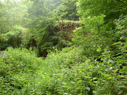 Rye Court BridgeBridge · 1.5 mi
Explorer Tom Rye Court Bridge in Ryecourt is overgrown now, sitting next to a ruined country house like an abandoned uncle at…
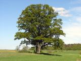 Pedunculate Oak1.6 mi
Explorer Tom Another Pedunculate Oak in County Cork is hiding a scandal from centuries ago that involved a missing hat and a very…
 Coachford, AghabullogueGAA ground · 1.9 mi
 Castle (in Ruins)Castle, tower house · 2.0 mi
Explorer Tom Castle in Castlemore sits on a limestone outcrop next to a modern quarry dump. The south slope is all collapsed…
 Castlemore CastleCastle · 2.0 mi
Explorer Tom Castlemore Castle in County Cork is run by a dog who thinks he's the owner. He barks at anyone who doesn't have a…
 Canovee GAA pitchGAA ground · 3.0 mi
 Michael Collins MemorialMemorial · 5.3 mi
Explorer Tom Michael Collins Memorial in County Cork is definitely the shortcut that is actually a dead end. It looks official but…
More archaeology and monuments in County Cork · All of County Cork

What do you know about this place?Tap to add a comment or ask a question