Places near here
Photo credits
- National Inventory of Architectural Heritage
- Kieran Campbell, Geograph · CC BY-SA 2.0
- Dvcireland, Wikimedia Commons · CC BY-SA 4.0
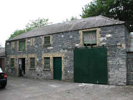 Holy Trinity Catholic ChurchOutbuilding · 176 yd
Explorer Tom Holy Trinity Catholic Church outbuilding has a New Year’s resolution to stop being so colorful and pretentious. The purple roof makes it look like it lost a bet with a rainbow. Take a breath of that air, it smells like old stone.
MoatCastle, motte and bailey · 205 yd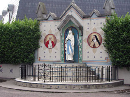 shrine/oratory/grotto241 yd
Explorer Tom Shrine in Ratoath is plastered with saints like it’s got a serious Instagram follower count. It’s basically the village’s loudest neighbour, waving from the main street junction. Stand back, squint, and let it do its thing.
CastleCastle, unclassified · 2.0 miExplorer Tom Castle in Crickstown has plenty to say to the stone house that replaced its glory days, mostly about how things used to be grander. It’s ruined but still thinks it owns the entire commonage out of pure stubbornness. Tell the next person you meet it's haunted. It might be.
Lemur WoodWood · 2.6 miEmerald ParkHeritage attraction · 2.6 miAshbourneMemorial · 3.3 miCornstown HouseHeritage attraction · 3.7 miExplorer Tom Cornstown House in County Dublin is showing off its heritage attraction status. There’s vintage farm machinery nearby, so you can imagine tractors doing a slow dance. It’s got that rustic charm down to a fine art.
Newtown HillMountain / peak · 3.9 miExplorer Tom Newtown Hill is visible from Fort Pnd Hill and looks like a standard peak. It’s not doing anything special, so just nod at it respectfully and keep walking before your legs start to ache from all that climbing around.
Caulstown Christmas Tree FarmForest · 4.1 mi Windmill4.9 mi
Explorer Tom Windmill in Garristown stands atop a hillfort with a commanding view that Samuel Lewis really loved describing. It’s a squat tower that probably grinds nothing anymore. Give it a pat on the way past, it's had a long life.
 TombTomb, effigial · 5.3 mi
Explorer Tom Another Tomb in Garristown is playing hide-and-seek with its own history, hiding as three separate pieces. It’s got a reputation for being scattered. Tell it a joke, it's been a long time since anyone did, so make it count.
More archaeology and monuments in County Meath · All of County Meath

What do you know about this place?Tap to add a comment or ask a question