What is recorded here
From the National Monuments Service (Archaeological Survey of Ireland) record DG016-005
Places near here
Photo credits
- Maker not stated on source page, www.flickr.com
- Maker not stated on source page, tr.pinterest.com
- Andreas F. Borchert, Wikimedia Commons · CC BY-SA 4.0
- Maker not stated on source page, commons.wikimedia.org
- National Inventory of Architectural Heritage
- Maker not stated on source page, www.pinterest.com
- Rossographer, Geograph · CC BY-SA 2.0
- CLG na nDúnaibh (official club site publisher); individual photographer not named, nadunaibh.ie
- Maker not stated on source page, en.wikipedia.org
- John M, Geograph · CC BY-SA 2.0
 Singing PubPub · 103 yd
Explorer Tom Singing Pub in Downings is probably just people yelling over bad acoustics while the storm outside brags about…
 Holy well in MíobhaighHoly well · 134 yd
Explorer Tom An older survey called Holy well in Míobhaigh a natural well, overgrown when recorded. Local people believed its water…
 Mevagh High CrossCross, High cross · 538 yd
Explorer Tom Mevagh High Cross is a stark, undecorated slab standing in the graveyard of a ruined medieval church. It’s simple and…
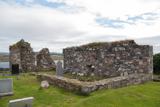 Mevagh Old ChurchChurch · 538 yd
Explorer Tom Mevagh Old Church was called an ancient ruined parish church in a 1622 record. The later survey describes parts of its…
 Mevagh GraveyardGraveyard · 547 yd
Explorer Tom Mevagh Graveyard surrounds a church that a 1622 account called 'ruinated'. The later survey still described an east…
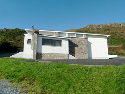 Stella Maris Catholic ChurchChurch/chapel · 909 yd
Explorer Tom Stella Maris Catholic Church has a least favourite visitor: anyone who thinks Modernist architecture is boring, which…
 Island RoaghIslet · 1.1 mi
Explorer Tom Island Roagh would describe itself as 'a sophisticated rock with commitment issues' if it could talk to a stranger. It…
 Beach HotelHotel · 1.2 mi
Explorer Tom Beach Hotel in County Donegal is right by the beach, which means sand everywhere, including in places you didn't know…
 Páirc na nDúnaibh, DowningsGAA ground · 1.2 mi
 InishfaughIslet · 1.2 mi
Explorer Tom Inishfaugh bragged to the next island that it survived a storm by holding its breath really hard. The other islands…
 Rosses StrandBeach / strand · 1.4 mi
Explorer Tom Rosses Strand sits on the Rosguill peninsula with the sort of Donegal scenery that makes a short stop expand into an…
DowningsOfficial bathing water · 1.4 miExplorer Tom Downings Beach gives its village a front row seat at Sheephaven Bay, with pale sand, calm-looking water and Muckish…
More archaeology and monuments in County Donegal · All of County Donegal

What do you know about this place?Tap to add a comment or ask a question