
What is recorded here
Internal Diam 18m E-W, 15m N-S Marked 'Killoran Burial Ground' (DG010-002005-) on the map. This is a subcircular enclosure defined by a low earthen bank, which encompasses a cross-inscribed stone (DG010-002003-), a probable broken cross (DG010-002002-), a small stone cross (DG010-002006-) and traces of a rectangular…
Read the whole record
From the National Monuments Service (Archaeological Survey of Ireland) record DG010-002006
Places near here
Photo credits
- Maker not stated on source page, ru.pinterest.com
- Maker not stated on source page, uk.pinterest.com
- Maker not stated on source page, www.stockvault.net
- Maker not stated on source page, au.pinterest.com
- N Chadwick, Geograph · CC BY-SA 2.0
- Andreas F. Borchert, Wikimedia Commons · CC BY-SA 4.0
- Mark McGaughey, Wikimedia Commons
- Maker not stated on source page, www.tuatha.ie
- Andrejs Plavins / Inishowen News, www.inishowennews.com
- Carroll Pierce, Wikimedia Commons
 Killoran Old Burial GroundGraveyard · 10 yd
Explorer Tom Killoran Old Burial Ground is a low earthen circle hiding cross-inscribed stones and church foundations on Binnion…
 Cross-inscribed stone in Binnion (straid Ed)Cross-inscribed stone · 12 yd
Explorer Tom Cross-inscribed stone in Binnion sits in a subcircular enclosure that looks like it’s guarding the coast from the SW…
 Stone CrossCross · 15 yd
Explorer Tom Stone Cross on Binnion Hill belongs to an enclosure that also holds inscribed and broken crosses. The survey found…
 Holy well in Binnion (straid Ed)Holy well · 480 yd
Explorer Tom This holy well in Binnion sits below the high tide mark, where the water stays fresh even when the sea rushes over it.…
 Glenevin Waterfall WalkOfficial walking route · 1468 yd
Explorer Tom Glenevin Waterfall Walk in County Donegal is basically a stream that has been told it’s a waterfall so many times it’s…
 Clonmany ChurchChurch · 1501 yd
Explorer Tom Clonmany Church was built in 1772, but a 1690 map puts a church and a castle in the surrounding area. The later church…
Clonmany Church of Ireland Parish ChurchChurch/chapel · 1502 ydExplorer Tom Clonmany Church of Ireland is talking to its younger self about why it let the roof fall in, which is a harsh…
 Straid ChurchRuins · 1504 yd
Explorer Tom Straid Church is a set of ruins in County Donegal, and I am delighted that the name sounds like it is constantly…
 CastleCastle, unclassified · 1504 yd
Explorer Tom A castle stood beside the church at Straid in 1600, perhaps a stone house occupied by a priest named Amerson. Its exact…
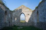 Clonmany Early Church GraveyardGraveyard · 1504 yd
Explorer Tom Clonmany Early Church Graveyard hides a stone with two cupmarks called St. Colmcille's knee-prints. I reckon a kneeling…
 Páirc Uí Chnáimhsí, UrrisGAA ground · 1724 yd
 Tullagh BaySurfing beach · 1753 yd
Explorer Tom Tullagh Bay curves below Binion Hill like someone drew a horseshoe in the sand and forgot to stop. Surfers know its…
More archaeology and monuments in County Donegal · All of County Donegal

What do you know about this place?Tap to add a comment or ask a question