
What is recorded here
In pasture, located on a ridge, just below and to E of the highest point, close to the break of slope where ground falls away to S, giving excellent views over the Palmerstown River estuary and Kilalla Bay. Nephin and the Nephin Beg mountain range define the far horizon to S-SW. There is a mound (MA015-025002-) 50m to…
Read the whole record
From the National Monuments Service (Archaeological Survey of Ireland) record MA015-025001
Places near here
Photo credits
- Maker not stated on source page, www.pinterest.com
- National Inventory of Architectural Heritage
- N Chadwick, Geograph · Creative Commons Attribution-ShareAlike 2.0
- N Chadwick, Wikimedia Commons · CC BY-SA 2.0
- Andreas F. Borchert, Wikimedia Commons · CC BY-SA 4.0
- Maker not stated on source page, tr.pinterest.com
- Maker not stated on source page, www.dreamstime.com
- Maker not stated on source page, en.wikipedia.org
- Kmcnamee, Wikimedia Commons · CC BY-SA 4.0
- Maker not stated on source page, www.alamy.com
 CastleCastle, unclassified · 231 yd
Explorer Tom Two families at Rathfran are still feuding over who owns the best view of nothing in particular. It’s a castle so…
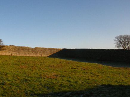 Summerhill HouseWalled garden · 233 yd
Explorer Tom Summerhill House in Rathfran is a walled garden that’s keeping its secrets tighter than a drum, or at least a very…
 Templemurry Grave YardGraveyard · 730 yd
Explorer Tom Templemurry graveyard sits on a hillock where the wind keeps picking on it, whistling through the gaps in its old walls…
 Templemurry GraveyardCemetery · 735 yd
Explorer Tom Templemurry Graveyard would survive a zombie attack simply by standing still and letting them trip over all the…
 Rathfran AbbeyVisitor attraction · 746 yd
Explorer Tom Rathfran Abbey in Mayo has an unlikely celebrity friend who is actually just a very persistent fox that refuses to…
 Rathfran Abbey in ruinsReligious house, Dominican friars · 766 yd
Explorer Tom Rathfran Abbey in ruins hosted a love story where the friar and the baker’s daughter had to hide their letters under…
 Ogham Stone1014 yd
Explorer Tom Ogham Stone in Breastagh would buy a boat if it won the lotto, but it’s stuck in coastal pasture. It’s been lying down…
 Megalithic tomb in BreastaghMegalithic tomb · 1186 yd
Explorer Tom Megalithic tomb in Breastagh is gone, which means the ghost moved to a nicer flat with better heating. Who wants an…
 Fairy fort / ringfort in SteelaunFairy fort / ringfort · 1490 yd
Explorer Tom Fairy fort / ringfort in Steelaun is guarding a hidden treasure that is definitely just an empty biscuit tin from 1952.…
Fairy fort / stone ringfort in Cashel (tirawley By.)Fairy fort / stone ringfort · 1656 ydExplorer Tom Vikings got so lost looking for this Fairy fort in Cashel that they ended up buying a pub instead of conquering it.…
 Lacken, Lacken Sarsfields GAAGAA ground · 1.4 mi
 Graveyard in KillogearyGraveyard · 1.9 mi
Explorer Tom Graveyard in Killogeary is currently in a furious dispute with the fairies over parking rights for their tiny carts.…
More archaeology and monuments in County Mayo · All of County Mayo

What do you know about this place?Tap to add a comment or ask a question