
Places near here
Photo credits
- Visitor, a visitor to Discover Alone · Displayed with the photographer's permission
- National Inventory of Architectural Heritage
- Andreas F. Borchert, Wikimedia Commons · CC BY-SA 4.0
- Picture: Carndonagh Heritage
- Andreas F. Borchert, Wikimedia Commons
 AltarPenal Mass station · 1189 yd
Explorer Tom Altar in Churchland Quarters is a bit of a map mystery, appearing on the newer OS sheets but vanishing from the first…
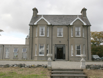 Donagh Lodge b&bHouse · 1297 yd
Explorer Tom Donagh Lodge B&B, built around 1910, makes quite an entrance: iron gates, coloured glass, double doors, then bay…
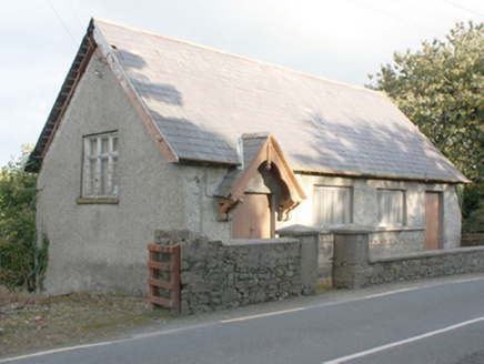 Carrick HallChurch hall/parish hall · 1384 yd
Explorer Tom Carrick Hall has been sheltering parish meetings since c. 1890, its gable-fronted porch looking like a fancy hat on a…
 Carndonagh Donagh Church Carved LintelArchitectural fragment · 1401 yd
Explorer Tom Lean in close to this Carndonagh Donagh Church Carved Lintel, as it’s been quietly propped against the church wall for…
 Carndonagh Donagh Church Gothic DoorwayArchitectural feature · 1402 yd
Explorer Tom The Carndonagh Donagh Church Gothic Doorway is a 15th-century masterpiece that has been shoved into an 18th-century…
 Donagh Church of Ireland ChurchChurch/chapel · 1411 yd
Explorer Tom Donagh Church of Ireland Church is a proper time capsule built in 1769. It sports a 15th-century stone doorway and a…
 Donagh ChurchChurch · 1411 yd
Explorer Tom Donagh Church has a borrowed doorway: a fifteenth-century stone entrance reused in an eighteenth-century building. Its…
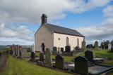 Carndonagh Early Church GraveyardGraveyard · 1415 yd
Explorer Tom Carndonagh Early Church Graveyard makes me slow the map down: it surrounds an eighteenth-century church thought to…
 Leaba Phádraig / Patrick's BedMegalithic tomb · 1424 yd
Explorer Tom Leaba Phádraig / Patrick's Bed is just a patch of bare soil near Carndonagh, but it’s still respected for cures. The…
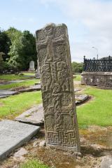 Cross-slab in Churchland QuartersCross-slab · 1428 yd
Explorer Tom Cross-slab in Churchland Quarters is famous for its 'Marigold' motif, which is actually a seven-rayed star. It looks…
 Former Site of Carndonagh South Pillar StoneStone sculpture · 1447 yd
Explorer Tom Former Site of Carndonagh South Pillar Stone marks where a sculpture used to stand flanking a high cross before erosion…
 Carndonagh North Pillar StoneStone sculpture (present location) · 1455 yd
Explorer Tom The Carndonagh North Pillar Stone stands guard beside the high cross, rescued from erosion on its new plinth. One face…
More mountains and hills in County Donegal · All of County Donegal

What do you know about this place?Tap to add a comment or ask a question