
What is recorded here
From OpenStreetMap (© OpenStreetMap contributors) n3180803462
Places near here
Photo credits
- Andreas F. Borchert, Wikimedia Commons · CC BY-SA 4.0
- Carroll Pierce, Wikimedia Commons · CC BY-SA 2.0
- Andreas F. Borchert, Wikimedia Commons · CC BY-SA 3.0 de
- Patrice78500, Wikimedia Commons · Public domain
- Maker not stated on source page, commons.wikimedia.org
- DAYVEHUSE, Wikimedia Commons · CC BY-SA 4.0
- Maker not stated on source page, tr.pinterest.com
- Maker not stated on source page, www.dreamstime.com
- Michael Dibb, Geograph · CC BY-SA 2.0
- N Chadwick, Geograph · CC BY-SA 2.0
- Maker not stated on source page, www.tuatha.ie
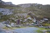 Saint Éigneach's WellHoly well · 1.2 mi
Explorer Tom Saint Éigneach's Well sits right on top of Mamore Gap, where pilgrims used to go barefoot around seven cairns. That’s a…
 Mamore GapViewpoint · 1.2 mi
Explorer Tom Mamore Gap has an imaginary twin across the sea that argues with it over who gets the better sunset every single…
 Mamore HillMountain / peak · 1.4 mi
Explorer Tom Right then, we've got ourselves a proper mountain called Mamore Hill tucked away in County Donegal. I imagine it's the…
 Urris HillsMountain / peak · 1.5 mi
Explorer Tom Urris Hills in County Donegal sounds like it's having a proper chat with the Gap of Mamore, judging by that caption.…
 R C ChurchChurch · 1.7 mi
Explorer Tom R C Church stands in a spot where the old graveyard used to be circular. I am trying to work out how you fit a square…
 Gortleck Catholic ChurchChurch/chapel · 1.7 mi
Explorer Tom Gortleck Catholic Church has a cross-shaped stone with cupmarks that look like someone used a spoon to dig tiny holes.…
 Cross-inscribed stone in GortleckCross-inscribed stone · 1.8 mi
Explorer Tom Cross-inscribed stone in Gortleck is sitting next to an old church that’s tilted NW-SE like it’s trying to lean in for…
 Greenhill GraveyardGraveyard · 1.8 mi
Explorer Tom Greenhill Graveyard has a curved wall that might follow an older enclosure, though the survey keeps that as a…
 Gap of Mamore ViewpointViewpoint · 1.8 mi
Explorer Tom Mamore Gap has a splendid trick: it makes you work for the view, then hands you half of Inishowen at once. The road…
 Dunree CentreMuseum · 3.3 mi
Explorer Tom Dunree Centre is one building in the Fort Dunree grounds, where the fort's story takes six exhibition chapters to tell.…
 Dunree HeadHeadland · 3.3 mi
Explorer Tom Dunree Head sticks its chin into Lough Swilly as though it has been appointed lookout for the whole of Donegal, and…
 CastleCastle, unclassified · 3.7 mi
Explorer Tom A castle stood beside the church at Straid in 1600, perhaps a stone house occupied by a priest named Amerson. Its exact…
More mountains and hills in County Donegal · All of County Donegal

What do you know about this place?Tap to add a comment or ask a question