
Places near here
Photo credits
- National Inventory of Architectural Heritage
- Kenneth Allen, Geograph · CC BY-SA 2.0
- Andreas F. Borchert, Wikimedia Commons · CC BY-SA 3.0 de
- Andreas F. Borchert, Wikimedia Commons · CC BY-SA 4.0
- William Frederick Wakeman (1822-1900), Wikimedia Commons · Public domain
- Kenneth Allen, Geograph · Creative Commons Attribution-ShareAlike 2.0
- Derek Henry, Geograph · CC BY-SA 2.0
- Mcg sean, Wikimedia Commons · CC BY-SA 3.0
- Photo courtesy PDPhoto.org, Wikimedia Commons · Public domain
 bridge1.3 mi
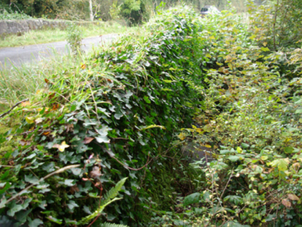
Explorer Tom Bridge in Tievemore has one round stone arch over a small tributary of the Termon River. The heritage survey found its sides screened by vegetation. A bridge playing hide-and-seek with its own banks! I cannot tell whether the leaves still win.
 Iniscilin BridgeBridge · 1.8 mi
Explorer Tom Iniscilin Bridge was built around 1780 with three arches over the Termon River, right on the Donegal-Fermanagh border. Its central piers have V-shaped stone cutwaters. I thought the river would divide the two counties; the bridge insists on introducing them.
 Patrick the PilgrimMemorial · 2.2 mi
Explorer Tom Patrick the Pilgrim stands there judging your life choices while St. Patrick’s Purgatory looms in the background like a bad dream waiting to happen. It would review its own visitors by saying 'good effort on the walking, poor choice of footwear' without even looking up. Hum something sad nearby, it adds atmosphere.
 Station IslandIsland · 2.6 mi
Explorer Tom Station Island is the Lough Derg pilgrimage island; the older monastery island is its neighbour, Saints Island. The traditional pilgrimage lasts three days. I would want the current dates and a proper booking sorted before I packed, because a lake crossing deserves more planning than my usual wandering.
 St Patrick's CrossCross · 2.6 mi
Explorer Tom St Patrick's Cross on Station Island is a 1.3m shaft wrapped in spiralling bands that look like ancient rope. It’s said to have been moved here from Saint's Island, which sounds like a bit of a logistical nightmare back then. Standing next to the penal beds, it feels like a tiny, confused survivor of a much bigger monastic operation.
 Saints IslandIsland · 3.3 mi
Explorer Tom Saints Island sounds like the place to land for the Lough Derg pilgrimage, but that is Station Island next door. This island held the early monastery; Lough Derg calls it overgrown and inaccessible. Even my map needs the two islands kept straight.
 Britton’s BarPub · 3.6 mi
Explorer Tom Britton’s Bar in Pettigo dates from eighteen sixty and smells like old wood and last calls. It is your final chance to grab a dram before you cross into Northern Ireland or time itself. A good place to forget your phone for ten minutes.
 Pettigo InnPub · 3.6 mi
Explorer Tom Pettigo Inn might be hiding a secret stash of pints behind the bar for the regulars. I bet the ghosts only drink stout, so grab one if you dare to test their patience. Visit, then text me what you think. I'll pretend to read it.
 Holy well: tober davagh in CrighdenisHoly Well: Tober Davagh · 4.0 mi
Explorer Tom Holy well: tober davagh in Crighdenis is allegedly best friends with a very chatty heron that squawks at anyone who looks too serious. It sits by the old school ruins, soaking up the echoes of lessons long forgotten and whispered prayers from ages past. Visit, then text me what you think. I'll pretend to read it.
 Drummoney WaterfallWaterfall · 4.1 mi
Explorer Tom Drummoney Waterfall’s name actually means 'the rock that fell down because it was tired,' which is very accurate. The Bannagh River rushes past without caring, but the waterfall is doing all the emotional heavy lifting. Grand place for a sulk or a snog, your call.
 Castle McGrathCastle · 4.8 mi
Explorer Tom Castle McGrath is recorded as a castle in County Donegal, and its location near Termonmcgrath gives it a solid, grounded feel. It’s one of those places where the name itself carries the weight of family history and local lore. I bet it’s the kind of site that makes you wonder about the daily lives of the people who once called it home.
 Drumskinny Stone CircleHeritage attraction · 4.8 mi
Explorer Tom Drumskinny Stone Circle in County Fermanagh nearly got famous when a tourist dropped their phone and the circle just stood there looking disappointed. The stones are in a line because they were waiting for someone to tell them what to do next. Stand there long enough and someone will ask if you're lost.
More mountains and hills in County Donegal · All of County Donegal

What do you know about this place?Tap to add a comment or ask a question