What is recorded here
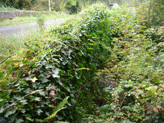
Single-arched bridge carrying road over small unnamed tributary of the Termon River built c. 1800. Coursed rubble stone construction to spandrels; coursed rubble stone parapets having rubble stone coping over. Cement rendered repairs in places and side elevations now largely obscured by vegetation. Round-headed arch having roughly dressed voussoirs; rubble stone construction to arch barrel. Tarmacadam deck with grass verges. Located in the rural countryside to the south-west of Glencolumbkille and to the north-east of Pettigoe.
Although now largely obscured by vegetation, this picturesque rustic bridge retains much of its early character, and is an appealing feature in the rural landscape to the north-east of Pettigoe. It is robustly-constructed in local rubble stone masonry, and its continued survival and use stands as testament to the quality of its original construction, and of the skill of the masons involved. This bridge is distinguished by the good-quality dressed voussoirs to the arch. This bridge probably originally dates to the late-eighteenth or early-nineteenth century, a period that saw a great deal of road and bridge-building throughout Ireland, particularly by the Grand Juries (the forerunners of the County Councils). This bridge is an integral element of the built heritage of the local area, and forms part of the extensive transport heritage of Donegal.
From the Buildings of Ireland (National Inventory of Architectural Heritage) record 40910205
This does not grant access. Most recorded buildings are privately owned; view them only from public ground unless the owner allows entry.
Places near here
Photo credits
- National Inventory of Architectural Heritage
- Derek Henry, Geograph · CC BY-SA 2.0
- Kenneth Allen, Wikimedia Commons · CC BY-SA 2.0
- Kenneth Allen, Geograph · CC BY-SA 2.0
- Photo courtesy PDPhoto.org, Wikimedia Commons · Public domain
- Dr Charles Nelson, Wikimedia Commons · CC BY-SA 2.0
- Andreas F. Borchert, Wikimedia Commons · CC BY-SA 3.0 de
- William Frederick Wakeman (1822-1900), Wikimedia Commons · Public domain
- Mcg sean, Wikimedia Commons · CC BY-SA 3.0
Grousehall ForestForest · 1.2 mi Cashelenny Church of Ireland ChurchChurch/chapel · 1.3 miIniscilin BridgeBridge · 1.4 miDrummoney WaterfallWaterfall · 2.8 miMontiaghroe Standing StonesPublicly named standing stone · 3.2 miPatrick the PilgrimMemorial · 3.5 miDrumskinny Stone CircleHeritage attraction · 3.5 miStone circle, cairn & alignment in DrumskinnyStone Circle, Cairn & Alignment · 3.6 miStation IslandIsland · 3.9 miSaints IslandIsland · 4.6 miCastle McGrathCastle · 4.8 miCastle McGrathCastle, tower house · 4.8 mi
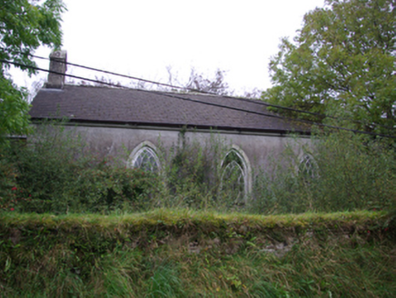 Cashelenny Church of Ireland ChurchChurch/chapel · 1.3 mi
 Iniscilin BridgeBridge · 1.4 mi
 Drummoney WaterfallWaterfall · 2.8 mi
 Montiaghroe Standing StonesPublicly named standing stone · 3.2 mi
 Patrick the PilgrimMemorial · 3.5 mi
 Drumskinny Stone CircleHeritage attraction · 3.5 mi
 Stone circle, cairn & alignment in DrumskinnyStone Circle, Cairn & Alignment · 3.6 mi
 Station IslandIsland · 3.9 mi
 Saints IslandIsland · 4.6 mi
 Castle McGrathCastle · 4.8 mi
 Castle McGrathCastle, tower house · 4.8 mi
More historic places in County Donegal · All of County Donegal
What do you know about this place?