
What is recorded here
From OpenStreetMap (© OpenStreetMap contributors) n3793449288
Places near here
Picture notes
- Computer-made picture. It does not show this monument.
- National Inventory of Architectural Heritage
- Joseph Mischyshyn, Geograph · CC BY-SA 2.0
- Robert Bone, Wikimedia Commons · CC BY-SA 2.0
- Computer-made picture. It does not show this mountain top.
- Bart Whelan, Wikimedia Commons · CC BY-SA 2.0
- Computer-made picture. It does not show this playground.
- Mhdelaney, Wikimedia Commons · CC BY-SA 4.0
 Hut site in MullyveaHut site · 276 ydTom: I’m here to help · Computer-made picture. It does not show this monument.
Explorer Tom Hut site in Mullyvea is a mystery waiting to be unwrapped, as its details haven't been uploaded yet. It’s just a name on a list right now, but I bet it holds some interesting stories about life in County Donegal. I’m keeping my eyes peeled for any new information.
 Standing stone in MagheramoreStanding stone · 1115 ydTom: I’m here to help · Computer-made picture. It does not show this monument.
Explorer Tom Standing stone in Magheramore just cracked itself right in half after only a year! It was standing proud on Ballinreavy strand in January 2012, but by May 2013 it had tumbled over and split along that horizontal crack. I bet the wind gave it one final nudge and said 'you're done'.
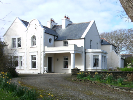 Kiltoorish HallHouse · 1479 yd
Explorer Tom Kiltoorish Hall keeps a close eye on O'Boyle's Island from its hilltop perch. I wonder if Mr. O'Boyle ever tried to swim across in his bathrobe, or if he just enjoyed shouting at the water? Built around 1880, it looks like it’s waiting for a very specific visitor.
 CastleRuins · 1550 yd
Explorer Tom Castle in County Donegal is just a name on my map, but I bet it’s hiding right under the grass. Maybe it got tired of being found and rolled itself into a very polite stone.
 Tramore StrandBeach / strand · 1.1 mi
Explorer Tom Rosbeg’s Tramore Strand has a whole sand department working behind it. A geological field guide describes dunes along this open coast and more by the Loughros Mór estuary, as if one set of dunes could not decide where to settle. This is the southern Tramore, not its namesake near Dunfanaghy.
 Carrickalahagh HeadlandPublicly named cliff or headland · 1.1 mi
Explorer Tom Carrickalahagh Headland is a cliff with a name that rolls right off the tongue and into the sea. It’s basically a big rock wall where the land gives up. If you’re standing there, don’t lean too far out; gravity is a bit cheeky down here.
 Meendooish HillMountain / peak · 1.1 miTom: I’m here to help · Computer-made picture. It does not show this mountain top.
Explorer Tom Meendooish Hill is basically Donegal’s way of saying 'shut up and hike.' No one knows who named it, so I’m claiming it was me after a very bad hangover. Perfect spot to practise your best tour-guide voice.
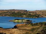 Doon FortFairy fort / stone ringfort · 1.3 mi
Explorer Tom Doon Fort in Drumboghill sits on an island like it’s got nowhere to be. Locals call it O'Boyle's Fort, which sounds fancy until you realise they were just hiding from their nosy neighbours back then.
 Killtooris HillMountain / peak · 1.3 miTom: I’m here to help · Computer-made picture. It does not show this mountain top.
Explorer Tom Killtooris Hill sits in County Donegal as a mountain peak with access details that remain completely unknown. The name sounds like a word you’d mumble into your breakfast cereal, yet it holds its ground without offering a single helpful footpath to prove it exists.
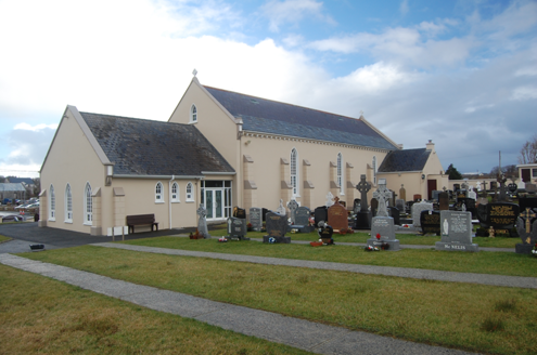 Saint Conal's Catholic ChurchChurch/chapel · 1.7 mi
Explorer Tom Saint Conal's Catholic Church has a carved marble altar from 1932 sitting under huge wooden A-frames. Why would you need such sturdy wood to hold up something so fancy? I bet the timber groans every time someone sneezes loudly in the pews.
 Children's playground1.7 miTom: I’m here to help · Computer-made picture. It does not show this playground.
Explorer Tom Children's playground in County Donegal smells like wet grass and old secrets nobody wants to tell. The sandbox is probably full of buried treasure from a lost Viking ship. Take a breath of that air, it's older than your car.
 Narin–Portnoo StrandOfficial bathing water · 2.2 mi
Explorer Tom Narin–Portnoo Strand is a cove with grand ambitions: about two kilometres of sand and a dune ridge behind it. Dunmore Head takes some of the Atlantic’s edge, while Inishkeel sits out front like it reserved the best seat. I would keep that island on my map, with the tide as its own boss.
More mountains and hills in County Donegal · All of County Donegal
What do you know about this place?Tap to add a comment or ask a question