
What is recorded here
From OpenStreetMap (© OpenStreetMap contributors) n3812043281
Places near here
Picture notes
- National Inventory of Architectural Heritage
- Computer-made picture. It does not show this mountain top.
- louise price, Wikimedia Commons · CC BY-SA 2.0
- Computer-made picture. It does not show this monument.
- Computer-made picture. It does not show this walking route.
- D Gore, Geograph · CC BY-SA 2.0
- William Frederick Wakeman (1822-1900), Wikimedia Commons · Public domain
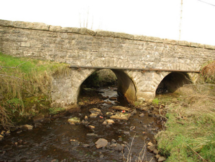 bridge1.0 mi
Explorer Tom Bridge in Cullionboy has a small cutwater on its middle pier and two low arches across the Lowerymore River. The old survey thought its shape may be earlier than its rock-faced stones suggest. I like that the bridge refuses one easy birthday.
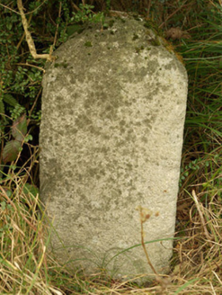 milestone/milepost1.1 mi
Explorer Tom Milestone or milepost in Cullionboy is a granite mystery with illegible inscriptions, so basically a rock with attitude. It used to measure distance in ‘Irish Miles’, which are longer than yours, so you’re technically always short by design. Bring curiosity, leave with a better story than mine about why it’s so grumpy.
 CroaghmeenMountain / peak · 1.2 miComputer-made picture
Explorer Tom Croaghmeen is locked in a bitter feud with the nearest tree, which refuses to grow taller just to spite it. It's the most dramatic hillside rivalry I've ever seen, and honestly, I'm taking the mountain's side. Whisper a secret at it; it keeps worse.
 The Ring, Leghawny Stone EnclosureEnclosure · 1.5 mi
Explorer Tom The Ring, Leghawny Stone Enclosure is soaked through and hides a seat-like stone structure called 'the Chair'. It’s not exactly comfortable, but it’s the perfect spot to watch the rain come down on Clogher Hill in absolute solitude.
 The RingStructure · 1.5 miComputer-made picture
Explorer Tom The Ring is actually a chair made of stones, which sounds like the most uncomfortable throne ever. I bet the king who sat there immediately asked for a cushion and got annoyed when it wasn't there.
 CroaghnamealMountain / peak · 2.0 miComputer-made picture
Explorer Tom Croaghnameal has strong opinions about modern buildings, particularly that they are all just glorified cardboard boxes with bad lighting. It sighs loudly whenever a new housing estate goes up nearby. Stand still and listen; the wind tells it better than me.
 Leghowney Loop WalkOfficial walking route · 2.0 miComputer-made picture
Explorer Tom Leghowney Loop Walk is six point nine kilometres of moderate effort where you’ll pretend to enjoy the silence. It’s a loop, so you end up where you started, just slower. Look up, the best bit is always higher than you think, probably.
IndicatedBawn · 2.7 miExplorer Tom Bawn in An Chorrmhín was where Sir Niall Garbh O'Donnell actually lived before things went pear-shaped in 1608. Fagan claimed a cheeky female figure carving used to sit here, but a search in 1981 found nothing. I bet she’s hiding behind those trees now!
Old CastleCastle, unclassified · 2.8 miExplorer Tom Old Castle on this tiny island was the O'Donnells' main squeeze for a while. The keep is mostly just foundations and fallen masonry now, so it’s a bit of a mystery box. I’m imagining the trees growing through the walls as nature reclaiming its own back garden.
 Harvey’s PointHotel · 3.2 mi
Explorer Tom Harvey’s Point Hotel has manicured lawns running down to the water, which sounds like a slippery slope. A Swiss family started it all! Wave to the lake for me, you gorgeous.
 Ard na Mona WoodOfficial walking route · 3.6 mi
Explorer Tom Ard na Mona Wood is an ancient oak woodland that’s seen better days but still rocks. It's a 1.9 km loop, perfect for a quick wander. Bring a coin for luck and keep it in your pocket for good measure.
 Saints IslandIsland · 5.9 mi
Explorer Tom Saints Island sounds like the place to land for the Lough Derg pilgrimage, but that is Station Island next door. This island held the early monastery; Lough Derg calls it overgrown and inaccessible. Even my map needs the two islands kept straight.
More mountains and hills in County Donegal · All of County Donegal

What do you know about this place?Tap to add a comment or ask a question