What is recorded here
From OpenStreetMap (© OpenStreetMap contributors) n332373324
Places near here
Photo credits
- louise price, Wikimedia Commons · CC BY-SA 2.0
- National Inventory of Architectural Heritage
- Wikimedia Commons contributor shown on the public file page · Public domain
- louise price, Geograph · CC BY-SA 2.0
- D Gore, Geograph · CC BY-SA 2.0
- William Frederick Wakeman (1822-1900), Wikimedia Commons · Public domain
- Andreas F. Borchert, Wikimedia Commons · CC BY-SA 4.0
- Andreas F. Borchert, Wikimedia Commons · CC BY-SA 3.0 de
- Kenneth Allen, Geograph · CC BY-SA 2.0
 The Ring, Leghawny Stone EnclosureEnclosure · 2.1 mi
Explorer Tom The Ring, Leghawny Stone Enclosure is soaked through and hides a seat-like stone structure called 'the Chair'. It’s not exactly comfortable, but it’s the perfect spot to watch the rain come down on Clogher Hill in absolute solitude.
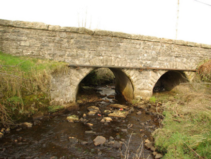 bridge2.2 mi
Explorer Tom Bridge in Cullionboy has a small cutwater on its middle pier and two low arches across the Lowerymore River. The old survey thought its shape may be earlier than its rock-faced stones suggest. I like that the bridge refuses one easy birthday.
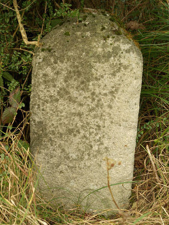 milestone/milepost2.2 mi
Explorer Tom This granite milestone at Cullionboy, erected around 1775, marks the former main road near the south-west end of Barnesmore Gap.
 BarnesmoreMountain / peak · 3.1 mi
Explorer Tom Barnesmore has been carrying the wrong name tag. Mountaineering Ireland calls this summit Croaghonagh and says Barnesmore belongs to the gorge below. I would ask the mountain to swap labels with the road, but it has stood its ground longer than my map has.
 Benson's HillMountain / peak · 3.8 mi
Explorer Tom Benson's Hill gives Lough Eske the barest of glances, like a shy wink. I reckon that hill is keeping its distance from the water, perhaps waiting for it to say hello first.
 IndicatedBawn · 3.8 mi
Explorer Tom Bawn in An Chorrmhín was where Sir Niall Garbh O'Donnell actually lived before things went pear-shaped in 1608. Fagan claimed a cheeky female figure carving used to sit here, but a search in 1981 found nothing. I bet she’s hiding behind those trees now!
 Harvey’s PointHotel · 4.3 mi
Explorer Tom Harvey’s Point Hotel has manicured lawns running down to the water, which sounds like a slippery slope. A Swiss family started it all! Wave to the lake for me, you gorgeous.
 Saints IslandIsland · 4.8 mi
Explorer Tom Saints Island sounds like the place to land for the Lough Derg pilgrimage, but that is Station Island next door. This island held the early monastery; Lough Derg calls it overgrown and inaccessible. Even my map needs the two islands kept straight.
 Ard na Mona WoodOfficial walking route · 4.8 mi
Explorer Tom Ard na Mona Wood is a 1.9 km loop in County Donegal, taking you through rare ancient oak woodland near Lough Eske.
 St Patrick's CrossCross · 5.5 mi
Explorer Tom St Patrick's Cross on Station Island is a 1.3m shaft wrapped in spiralling bands that look like ancient rope. It’s said to have been moved here from Saint's Island, which sounds like a bit of a logistical nightmare back then. Standing next to the penal beds, it feels like a tiny, confused survivor of a much bigger monastic operation.
 Station IslandIsland · 5.5 mi
Explorer Tom Station Island is the Lough Derg pilgrimage island; the older monastery island is its neighbour, Saints Island. The traditional pilgrimage lasts three days. I would want the current dates and a proper booking sorted before I packed, because a lake crossing deserves more planning than my usual wandering.
 Patrick the PilgrimMemorial · 5.8 mi
Explorer Tom Patrick the Pilgrim stands in County Donegal with St. Patrick's Purgatory looming in the background. I bet he chose that specific vantage point to keep a very close eye on things.
More mountains and hills in County Donegal · All of County Donegal
What do you know about this place?Tap to add a comment or ask a question