
What is recorded here
From OpenStreetMap (© OpenStreetMap contributors) n3803850625
Places near here
Photo credits
- Maker not stated on source page, ru.pinterest.com
- National Inventory of Architectural Heritage
- louise price, Wikimedia Commons · CC BY-SA 2.0
- Maker not stated on source page, commons.wikimedia.org
- Maker not stated on source page, www.youtube.com
- Kenneth Allen, Geograph · CC BY-SA 2.0
- louise price, Geograph · CC BY-SA 2.0
- Donegal Daily (publisher); individual photographer not stated, www.donegaldaily.com
 Mapped graveyardGraveyard · 1.4 mi
Explorer Tom The most dramatic thing to ever happen at this unmapped graveyard was a pigeon landing on a headstone with suspicious…
 mausoleum1.4 mi
Explorer Tom Mausoleum in Drumnasillagh is hosting a very exclusive afterlife club where only the MacLoones and Bishop Kennedy are…
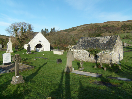
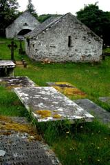 Inishkeel Graveyard near GlentiesGraveyard · 1.5 mi
Explorer Tom Inishkeel Graveyard near Glenties was rectangular in the older survey, but its south side sat on part of a roughly…
 Burial ground in Lag Na GaileadhBurial ground · 1.6 mi
Explorer Tom The Burial ground in Lag Na Gaileadh is a quiet oval mound on the bank of the Owenea river. It holds a stone slab with…
 Fairy fort / ringfort in An Tard Donn,droim Chon CuaisFairy fort / ringfort · 1.7 mi
Explorer Tom Fairy fort / ringfort in An Tard Donn, Droim Chon Cuais came from local tradition on Crockmore hill. The survey found…
 McDevitt's BridgeBridge · 1.9 mi
Explorer Tom McDevitt's Bridge, built c.1780, crosses the Owenea River on three segmental arches. Those cut-stone triangular…
 GlentiesHostel · 2.4 mi
Explorer Tom Glenties Hostel is where you sleep in a bed that has seen far too much drama already. Bring an earplug because snoring…
 Kennedy's Bar and RestaurantRestaurant · 2.4 mi
Explorer Tom Kennedy's Bar and Restaurant is definitely hiding a secret menu involving only cabbage and regret. I bet the barman…
 St. Connell's Museum and Heritage CentreMuseum · 2.4 mi
Explorer Tom St Connell's Museum in Glenties makes an old courthouse speak about Donegal lives, from railway journeys to the people…
 CarnaweenMountain / peak · 2.4 mi
Explorer Tom Carnaween has Diarmuid Ó Duibhne hiding in its name, at least in the old local telling. There was even a…
 Davy Brennan Memorial ParkGAA ground · 2.9 mi
 Binn BhánMountain / peak · 3.4 mi
Explorer Tom Binn Bhán is recorded as a mountain / peak in County Donegal. It is hilarious that the ground goes from boggy to…
More mountains and hills in County Donegal · All of County Donegal

What do you know about this place?Tap to add a comment or ask a question