
What is recorded here
From OpenStreetMap (© OpenStreetMap contributors) n332372924
Places near here
Picture notes
- Wikimedia Commons contributor shown on the public file page · Public domain
- Computer-made picture. It does not show this mountain top.
- National Inventory of Architectural Heritage
- Computer-made picture. It does not show this monument.
- D Gore, Geograph · CC BY-SA 2.0
- Computer-made picture. It does not show this walking route.
 BarnesmoreMountain / peak · 1.1 mi
Explorer Tom Barnesmore has been carrying the wrong name tag. Mountaineering Ireland calls this summit Croaghonagh and says Barnesmore belongs to the gorge below. I would ask the mountain to swap labels with the road, but it has stood its ground longer than my map has.
 CroaghonaghMountain / peak · 1.1 miComputer-made picture
Explorer Tom Croaghonagh has a standing stone nearby that might be listening. The maps say 'Giants Bed', but I say it's just a very long nap. Have a look and decide if I was lying or just being dramatic.
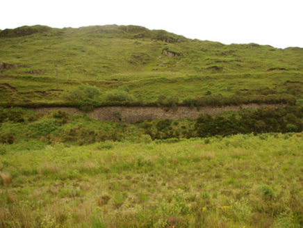 viaduct, bridge, embankment1.2 mi
Explorer Tom Viaduct, Bridge, Embankment in Keadew Upper marks the old railway route into the Barnesmore Gap. The line opened towards Donegal Town in 1889 and later changed gauge; that plain stone bridge kept its place after trains stopped in 1960.
 Old BarracksBarracks · 2.0 mi
Explorer Tom Old Barracks was built to guard Barnesmore Gap from highwaymen and brigands. It’s just fragmentary remains now, but imagine the Red Coats keeping watch there! I bet you could hear the echoes of history in the wind.
 A.p. SiteA.p. Site, Crannog? · 2.5 miComputer-made picture
Explorer Tom A.p. Site has caught my eye in Slievedoo, County Tyrone. I bet a a.p. site, crannog? with a name like that could keep me talking all afternoon; I'm already inventing a daft little scene for it, and I'll stop before it turns into history.
 Island, possibly crannog in SlievedooIsland, possibly crannog · 2.7 miComputer-made picture
Explorer Tom Island, Possibly crannog in Slievedoo has caught my eye in Slievedoo, County Tyrone. I bet a island, possibly crannog with a name like that could keep me talking all afternoon; I'm already inventing a daft little scene for it, and I'll stop before it turns into history.
 Ard na Mona WoodOfficial walking route · 3.8 mi
Explorer Tom Ard na Mona Wood is an ancient oak woodland that’s seen better days but still rocks. It's a 1.9 km loop, perfect for a quick wander. Bring a coin for luck and keep it in your pocket for good measure.
Old CastleCastle, unclassified · 3.9 miExplorer Tom Old Castle on this tiny island was the O'Donnells' main squeeze for a while. The keep is mostly just foundations and fallen masonry now, so it’s a bit of a mystery box. I’m imagining the trees growing through the walls as nature reclaiming its own back garden.
IndicatedBawn · 3.9 miExplorer Tom Bawn in An Chorrmhín was where Sir Niall Garbh O'Donnell actually lived before things went pear-shaped in 1608. Fagan claimed a cheeky female figure carving used to sit here, but a search in 1981 found nothing. I bet she’s hiding behind those trees now!
 Harvey’s PointHotel · 4.0 mi
Explorer Tom Harvey’s Point Hotel has manicured lawns running down to the water, which sounds like a slippery slope. A Swiss family started it all! Wave to the lake for me, you gorgeous.
 Leghowney Loop WalkOfficial walking route · 4.7 miComputer-made picture
Explorer Tom Leghowney Loop Walk is six point nine kilometres of moderate effort where you’ll pretend to enjoy the silence. It’s a loop, so you end up where you started, just slower. Look up, the best bit is always higher than you think, probably.
Ardnamona Nature ReserveNational nature reserve · 5.3 miExplorer Tom Ardnamona Nature Reserve is basically a big, fancy oak park near Lough Eske where the trees act like they're running the whole show. Forty-six hectares of serious green business that's been around longer than your gran. Give me a thumbs-up from the middle of it!
More mountains and hills in County Donegal · All of County Donegal

What do you know about this place?Tap to add a comment or ask a question