
What is recorded here
From OpenStreetMap (© OpenStreetMap contributors) w849312682
Places near here
Photo credits
- National Inventory of Architectural Heritage
- Maker not stated on source page, ru.pinterest.com
- Maker not stated on source page, global-geography.org
- Maker not stated on source page, en.wikipedia.org
- Maker not stated on source page, www.flickr.com
- Maker not stated on source page, www.pinterest.com
- Maker not stated on source page, www.wikidata.org
- Maker not stated on source page, uk.pinterest.com
- Maker not stated on source page, commons.wikimedia.org
- Michael Dibb, Wikimedia Commons · CC BY-SA 2.0
 farm house121 yd
Explorer Tom Farm house in Tully More is a c. 1800 survivor with that traditional open stone drain running from the door to the…
 Castle FortArchaeological place · 1276 yd
Explorer Tom Castle Fort is recorded as an archaeological place in County Donegal, and its name suggests a spot where people built…
 Megalithic tomb in BallaghMegalithic tomb · 1347 yd
Explorer Tom Megalithic tomb in Ballagh is basically a broken skeleton on a boggy ridge. Locals claim a coffin-shaped capstone used…
 Holy well in DunagardHoly well · 1.3 mi
Explorer Tom Holy well in Dunagard is unlocated, but a 1936 account tells a lively story about nearby St Patrick's lake: fasting…
 Standing stone in Carrowmore (malin Ed)Standing stone · 1.4 mi
Explorer Tom Standing stone in Carrowmore has two other stones sitting right beside it, one lying flat like a lazy cat. I bet…
 Lougherbraghy Children's Burial GroundChildren's burial ground · 1.5 mi
Explorer Tom Lougherbraghy Children's Burial Ground is a lumpy earthen mound sitting right by a stream curve. It’s locals who named…
 Standing stone in NorriraStanding stone · 1.7 mi
Explorer Tom Standing stone in Norrira is just a big lump of rock claiming to be special because some local guy swears he invented…
 Balleelaghan Recorded Burial GroundBurial ground · 1.8 mi
Explorer Tom Balleelaghan Recorded Burial Ground is hiding in plain sight between a rocky outcrop and a stream. Locals aren’t…
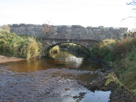 Keenagh BridgeBridge · 1.9 mi
Explorer Tom Keenagh Bridge has been spanning the river with a single limestone arch since c. 1860, its rock-faced voussoirs showing…
 Standing stone in DrumcarbitStanding stone · 2.0 mi
Explorer Tom The Standing stone in Drumcarbit is in a lifelong feud with the rain because it thinks being wet is a personal insult.…
 Mapped cemeteryCemetery · 2.0 mi
Explorer Tom “Mapped cemetery” in County Donegal has a family tree that’s mostly made up by people who just wanted to sound…
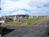 Lag GraveyardGraveyard · 2.0 mi
Explorer Tom Lag Graveyard lies in a natural enclosure of sandhills north of the Trawbreaga Bay channel. The survey found a short…
More archaeology and monuments in County Donegal · All of County Donegal

What do you know about this place?Tap to add a comment or ask a question