What is recorded here
From OpenStreetMap (© OpenStreetMap contributors) w1328447729
Places near here
Photo credits
- National Inventory of Architectural Heritage
- Michael Dibb, Geograph · Creative Commons Attribution-ShareAlike 2.0
- Michael Dibb, Wikimedia Commons · CC BY-SA 2.0
- michael clarke stuff, Wikimedia Commons · CC BY-SA 2.0
- Willie Duffin, Geograph · CC BY-SA 2.0
- Corinna Schleiffer, Geograph · CC BY-SA 2.0
- Wanfried-Dublin, Wikimedia Commons · CC BY-SA 4.0
- N Chadwick, Geograph · CC BY-SA 2.0
- Dr Neil Clifton, Geograph · CC BY-SA 2.0
- Dr Neil Clifton, Wikimedia Commons · CC BY-SA 2.0
- Kenneth Allen, Geograph · CC BY-SA 2.0
 farm house1239 yd
Explorer Tom Farm house in Tully More is a c. 1800 survivor with that traditional open stone drain running from the door to the lane. It’s a small, honest farm setup with high-quality sash windows that arrived later during extensions. The whole complex feels like a well-kept historical snapshot.
 St. Mary's Catholic ChurchChurch/chapel · 1.3 mi
Explorer Tom Step into the grounds of St. Mary's Catholic Church in Lag, built back in 1784 and reportedly the first chapel of its kind in Inishowen. The T-shaped plan might look a bit odd at first, but it’s actually a later adaptation from after Catholic Emancipation, so keep your eyes peeled for those early 18th-century gravemarkers while you’re here.
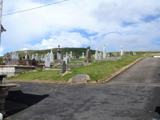 Lag GraveyardGraveyard · 1.3 mi
Explorer Tom Lag Graveyard lies in a natural enclosure of sandhills north of the Trawbreaga Bay channel. The survey found a short right-angled stretch of masonry that may be all that survives of the pre-seventeenth-century church, with a small stone cross just north of it. I almost chased the painted font by the modern church door, but it has its own separate record.
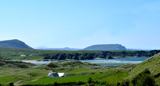 Five Finger StrandBeach / strand · 1.7 mi
Explorer Tom Five Finger Strand near Malin features rocky fingers reaching into the surf, backed by huge dunes that feel wild.
 Doagh Famine VillageMuseum · 2.1 mi
Explorer Tom Doagh Famine Village tells this coast's history through homes, voices and a guided tour. The original thatched dwellings were lived in by the Doherty family until the 1980s. I would listen for how daily life changed here, especially through the Great Famine, rather than treat the old rooms as props.
 Dough Famine VillageHeritage attraction · 2.1 mi
Explorer Tom Dough Famine Village jumps straight from the 1970s back to the 1840s. I suspect the timeline took a very short cut to get there. It feels like a museum that skipped a few centuries just to save space.
.jpg/250px-Magheranaul_(3).jpg "Photo: Wanfried-Dublin, Wikimedia Commons · CC BY-SA 4.0") Magheranaul Wedge TombWedge tomb · 2.4 mi
Magheranaul Wedge TombWedge tomb · 2.4 miExplorer Tom Magheranaul Wedge Tomb has a single roofstone covering its gallery, with an hour-glass hole bored right through the closing stone. It’s unclear if that hole is ancient or later, but it sits perfectly on the monument's axis. A real head-scratcher hidden in the pasture.

 E. McCleanRestaurant · 2.5 mi
Explorer Tom E. McClean is a great restaurant now, with lunch or dinner worth turning up for. Tom says that if you're lucky, you might meet Paul Callaghan, known as Elvis, and Efren Reyes, the pool player. He's bringing an appetite and keeping an eye out.
 White StrandGuesthouse · 2.7 mi
Explorer Tom White Strand is probably white because it hasn't been cleaned since 1954. The guesthouse beds are likely made with feathers that belong to very angry geese. Fluff them up!
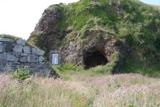 Wee House of Malin CaveCave · 3.1 mi
Explorer Tom Wee House of Malin Cave is measured at only 2.75 metres deep, yet the local saying gives it room for everything that goes in. That is one ambitious little house. The recorded cave sits beside Malin Well and the old church; I would let the story stretch the walls while leaving the real rock alone.
 Bawn in CarrickabraghyBawn · 3.2 mi
Explorer Tom Bawn in Carrickabraghy has a rare witness in writing: a Plantation-era account says Lieutenant Hoan had finished a lime-and-stone bawn while bound to rebuild the castle. The castle stood on a seashore promontory. I would like to match that old sentence to the broken walls, without giving every surviving stone to Hoan.
 Carrickabraghy CastleCastle · 3.2 mi
Explorer Tom Carrickabraghy Castle sits on a rock where the Atlantic probably splashes right up its nose. I bet a Viking once stood there, held his shield high, and shouted 'we live here now' while trying not to slip on the wet stones.
More castles and forts in County Donegal · All of County Donegal

What do you know about this place?Tap to add a comment or ask a question