What is recorded here
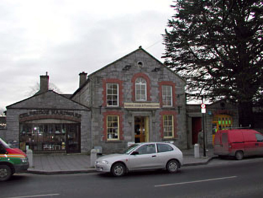
Attached three-bay (four-bay deep) two-storey gable-fronted courthouse, built 1801, on a rectangular plan. Renovated, 1985, to accommodate alternative use. Pitched (gable-fronted) and hipped slate roof with clay ridge tiles, roll topped cut-granite coping to gable on cut-granite "Cavetto" kneelers, rooflights, and replacement uPVC rainwater goods with replacement downpipes. Repointed snecked limestone wall to front (west) elevation with benchmark-inscribed cut-granite quoins to corners; coursed rubble limestone walls (remainder). Square-headed central door opening with cut-granite step threshold, cut-granite doorcase with ogee-detailed hood moulding on rosette-detailed fluted scroll consoles framing timber panelled double doors. Round-headed central window opening (first floor) with cut-granite sill, and red brick block-and-start surround framing timber fitting. Square-headed window openings with cut-granite sills, and red brick block-and-start surrounds framing four-over-four timber sash windows. Street fronted with concrete flagged footpath to front.
A courthouse representing an important component of the early nineteenth-century built heritage of Celbridge with the architectural value of the composition, one evoking comparisons with the later Newbridge Courthouse (1858; see 11818015), confirmed by such attributes as the compact rectilinear plan form centred on a Classically-detailed doorcase demonstrating good quality workmanship in a silver-grey granite; the construction in a blue-grey limestone with red brick dressings producing an eye-catching two-tone palette; the very slight diminishing in scale of the openings on each floor producing a feint graduated visual impression; and the gabled roofline: meanwhile, a benchmark remains of additional interest for the connections with cartography and the preparation of maps by the Ordnance Survey (established 1824).
From the Buildings of Ireland (National Inventory of Architectural Heritage) record 11805033
This does not grant access. Most recorded buildings are privately owned; view them only from public ground unless the owner allows entry.
Places near here
Arthur GuinessMemorial · 18 yd Landscape HouseHouse · 22 ydKildrought HouseHouse · 27 ydCommon Lime168 ydJohn McLaughlinMemorial · 467 ydCelbridge Union Workhouse, site ofArchaeological place · 490 ydOriental plane648 ydIndicatedEcclesiastical enclosure · 730 ydCastleCastle, unclassified · 1028 ydCastletown HouseHeritage attraction · 1174 ydBerkeley Costume and Toy CollectionMuseum · 1218 ydCastleCastle, tower house · 1491 yd
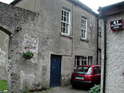 Landscape HouseHouse · 22 yd
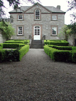 Kildrought HouseHouse · 27 yd
 Common Lime168 ydJohn McLaughlinMemorial · 467 ydCelbridge Union Workhouse, site ofArchaeological place · 490 yd
 Oriental plane648 ydIndicatedEcclesiastical enclosure · 730 ydCastleCastle, unclassified · 1028 yd
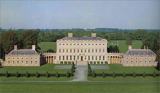 Castletown HouseHeritage attraction · 1174 ydBerkeley Costume and Toy CollectionMuseum · 1218 ydCastleCastle, tower house · 1491 yd
Pictures: National Inventory of Architectural Heritage; Alvesgaspar, Wikimedia Commons · CC BY-SA 3.0; Superchilum, Wikimedia Commons · CC BY-SA 4.0; DiggingSpace, Wikimedia Commons · CC BY-SA 4.0
More historic places in County Kildare · All of County Kildare
What do you know about this place?