
What is recorded here
From the Northern Ireland Sites and Monuments Record record FER261:016
Places near here
Photo credits
- Maker not stated on source page, great-castles.com
- Maker not stated on source page, www.ireland.com
- Eric Jones, Wikimedia Commons · CC BY-SA 2.0
- Maker not stated on source page, www.pinterest.com
- Ulster GAA; individual photographer not stated, ulster.gaa.ie
- Maker not stated on source page, uk.pinterest.com
- Stephen McKay, Geograph · CC BY-SA 2.0
- Maker not stated on source page, www.flickr.com
- Maker not stated on source page, www.dreamstime.com
- Maker not stated on source page, tr.pinterest.com
- Kenneth Allen, Wikimedia Commons · CC BY-SA 2.0
- Peter Robinson, Geograph · CC BY-SA 2.0
 Castle in Drumbrughas EastCastle · 1289 yd
Explorer Tom Castle in Drumbrughas East in Fermanagh is playing hard to get. I bet it's hiding behind a hedge because it knows it…
 Castle (unlocated) in DerrycorbyCastle (unlocated) · 1378 yd
Explorer Tom Castle in Derrycorby is unlocated and post-medieval, so it’s hiding from history class. I bet there was a smuggling…
 Battle of NewtownbutlerBattle · 1712 yd
Explorer Tom Battle of Newtownbutler got the map makers so confused they ended up putting the town on the wrong side of the river…
 Mapped graveyardGraveyard · 1.0 mi
Explorer Tom The builder who made this place was clearly thinking about lunch while laying the last row of stones, because it just…
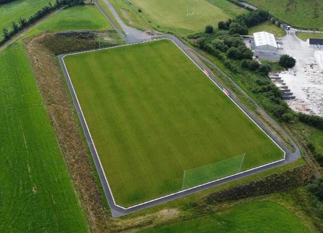 Newtownbutler GAA Grounds, First Fermanagh's GAA, NewtownbutlerGAA ground · 1.2 mi
 Holy well (unlocated) in GalloonHoly well (unlocated) · 1.6 mi
Explorer Tom Holy well in Galloon has a family tree that I invented on the spot, featuring an uncle who was a wizard and a cousin…
 Galloon IslandIsland · 1.7 mi
Explorer Tom Galloon Island in Fermanagh would handle a nosey neighbour by growing thorns all over its main path so they trip and…
 C6th Monastery; Multiperiod Church Site; Graveyard; Two-cross Shafts; Bases in GalloonC6th Monastery · 1.8 mi
Explorer Tom Galloon’s C6th monastery has a graveyard and two-cross shafts. It’s been around since before fashion was really a…
 Derryvony ForestForest · 2.2 mi
Explorer Tom Derryvony Forest swears it has been standing there since the dinosaurs were still figuring out how to walk upright…
 Penitential station stones (associated with Fer 0272:003, Holy Well) in KiltoberPenitential station stones (associated with Fer 0272:003, Holy Well) · 2.6 mi
Explorer Tom Penitential station stones in Kiltober are associated with a holy well that probably smells like wet socks and regret…
 Turf HouseVisitor attraction · 2.6 mi
Explorer Tom Turf House in Fermanagh would win a county fair prize for 'Most Suspiciously Shaped Mound' without breaking a sweat. It…
 Inisherk Trail, CromWalking route · 3.0 mi
Explorer Tom Inisherk Trail would survive a zombie apocalypse by simply letting them fall off the edge into the lough below. It’s…
More archaeology and monuments in County Fermanagh · All of County Fermanagh

What do you know about this place?Tap to add a comment or ask a question