What is recorded here
Map note: The map marks Coumaraglin Mountain as a mountain or peak in County Waterford, Ireland. That sounds like a place for a big view, though the map makes no promises.
Coumaraglin Mountain is recorded as a mountain / peak in County Waterford.
From OpenStreetMap (© OpenStreetMap contributors) n332372757
Places near here
Photo credits
- kevin higgins, Wikimedia Commons · CC BY-SA 2.0
- kevin higgins, Geograph · CC BY-SA 2.0
- National Inventory of Architectural Heritage
- Rwxrwxrwx at English Wikipedia, Wikimedia Commons · Public domain
- Colin Park, Geograph · CC BY-SA 2.0
- Kevin O'Brien 13, Wikimedia Commons · CC BY-SA 4.0
Pile of StonesCairn, boundary cairn · 682 yd Standing StoneRuins · 1293 ydSeefinMountain / peak · 1.7 mimill (water)2.0 miSaint Bridget's Catholic ChurchOfficially recorded historic building · 2.0 miBawn in BarnankileBawn · 2.3 miMahon ValleyCliff · 3.3 miCrough WoodWood · 3.4 miMahon FallsWaterfall · 3.5 miCoumfeaMountain / peak · 3.5 miSite of CastleCastle, unclassified · 3.5 miCoumshingaunMountain corrie and lake · 5.0 mi
 Standing StoneRuins · 1293 yd
 SeefinMountain / peak · 1.7 mi
 mill (water)2.0 mi
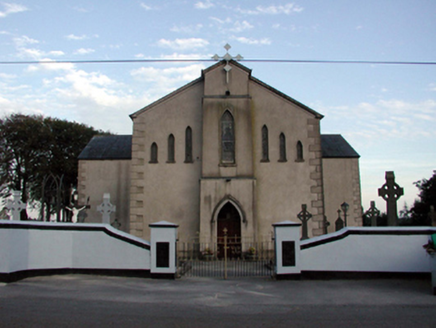 Saint Bridget's Catholic ChurchOfficially recorded historic building · 2.0 miBawn in BarnankileBawn · 2.3 mi
 Mahon ValleyCliff · 3.3 miCrough WoodWood · 3.4 mi
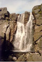 Mahon FallsWaterfall · 3.5 mi
 CoumfeaMountain / peak · 3.5 miSite of CastleCastle, unclassified · 3.5 mi
 CoumshingaunMountain corrie and lake · 5.0 mi
More mountains and hills in County Waterford · All of County Waterford

What do you know about this place?Tap to add a comment or ask a question