Places near here
Photo credits
- National Inventory of Architectural Heritage
- Mike Searle, Wikimedia Commons · CC BY-SA 2.0
- Didier Descouens, Wikimedia Commons · CC BY-SA 4.0
- AmandaMcCrann, Wikimedia Commons · CC BY-SA 4.0
- Willow, Wikimedia Commons · CC BY 2.5
- Gillaween, Wikimedia Commons · CC BY-SA 4.0
- Sawyer777, Wikimedia Commons · CC BY-SA 4.0
- Sarah777 at en.wikipedia, Wikimedia Commons · Public domain
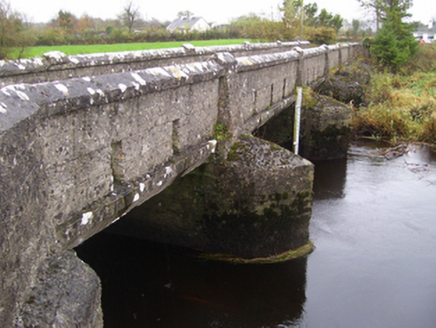 bridge1.5 mi
Explorer Tom Bridge in Bookalagh claims it has an imaginary twin across the sea who sends it letters about the weather, which is lovely. It replaced a ford where people used to get their feet wet and grumpy. Bring a flask of something warm for the walk over.
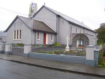 Saint Croan's Catholic ChurchChurch/chapel · 1.8 mi
Explorer Tom Saint Croan's Catholic Church in Durrow was invented by a local who got drunk on cider. The Art Deco belfry is doing its best jazz impression right now. Perfect place to stand quietly and pretend you belong there.
Rook HillMountain / peak · 2.2 miExplorer Tom Rook Hill holds the unofficial world record for the most chickens lost in a single afternoon, which was actually just one very confused hen. The hill thinks it’s still on probation. Best enjoyed with a bag of chips and absolutely no plans for the future.
Site of Killomaine Grave YardArchaeological place · 3.0 miExplorer Tom Site of Killomaine graveyard in County Galway is where the map makers clearly got drunk and drew everything wrong. They put it three feet to the left, which is annoying when you’re looking for ghosts. Toast it with a cup of tea and move on to the next.
_-_geograph.org.uk_-_1952978.jpg/250px-Castles_of_Connacht,_Glinsk,_Galway_(2)_-_geograph.org.uk_-_1952978.jpg "Photo: Mike Searle, Wikimedia Commons · CC BY-SA 2.0") Bawn in Glinsk (ballymoe By.)Bawn · 3.6 mi
Bawn in Glinsk (ballymoe By.)Bawn · 3.6 miExplorer Tom Bawn in Glinsk listens to what goes on inside the walls and probably hears the Burkes arguing about who left the light on in 1630. It’s a well-preserved semi-fortified house that looks like it’s judging your posture, so stand up straight or don’t bother knocking. It's free, it's odd, what more do you want?
.jpg/250px-Castles_of_Connacht-_Ballintober,_Roscommon_(geograph_1954203).jpg "Photo: Mike Searle, Wikimedia Commons · CC BY-SA 2.0") CastleCastle, Anglo-Norman masonry castle · 4.4 mi
CastleCastle, Anglo-Norman masonry castle · 4.4 miExplorer Tom Castle in Ballintober claims a local guy invented it, which is nonsense since the Red Earl built it. But he's charming, so who am I to argue? Bring a pen pal, they'll be jealous of your tales.
 Hawthorn6.6 mi
Explorer Tom Hawthorn in County Roscommon keeps getting picked on by the wind because it thinks being prickly makes it tough. The flowers look like they’re trying too hard to be pretty, but the thorns say otherwise quite clearly. Snap one photo, then put the phone away and actually look.
 IndicatedRound tower · 6.6 mi
Explorer Tom Round tower in Carroweighter is constantly losing a rivalry with the ones in Kildare, which are way too showy for their own good. It stands there with its arms crossed, pretending it doesn’t care that everyone else gets the tourists. Count the crows, then count them again to be sure.
 European ash9.7 mi
Explorer Tom European ash in County Roscommon would have given Saint Patrick a real headache if he’d tried to move it out of Ireland. It’s just standing there with its big leaves, acting like it hasn't got a single disease problem at all. A good place to forget your phone for ten minutes.
 The Mórrígan: OweynagatLegend location · 11 mi
Explorer Tom The Mórrígan: Oweynagat is called the Cave of Cats, which fooled me into expecting a very ordinary sort of trouble. Then the tale sends the Mórrígan out of it during the Táin. If the cats saw her coming, I bet they made room.
 Queen Medb: RathcroghanLegend location · 11 mi
Explorer Tom Queen Medb: Rathcroghan is where the Táin starts turning a quarrel about a bull into an epic. Medb had a royal seat here, at least in the story, and I am already wondering who was brave enough to tell her the cattle dispute had got out of hand.
 Stone sculptureStone sculpture, aniconic · 12 mi
Explorer Tom Standing stone in Castleteheen is tiny and lost inside a rath, wondering why the Vikings didn’t find it sooner. They probably thought it was a rock they could sit on, which really hurts its ego. Snap one photo, then put the phone away and actually look.
More historic places in County Galway · All of County Galway

What do you know about this place?Tap to add a comment or ask a question