What is recorded here
Roadside in Massytown, Macroom. According to owner oat mill built in 1832 onto earlier carding, mill by Walton family who came from nearby flour mill (CO071-047001-). Rectangular carding mill (19.1m N-S; 12.2m E-W) used now as corn store. Oat mill built onto W side of carding mill, indicated on 1842 OS 6-inch map as…
Read the whole record
From the National Monuments Service (Archaeological Survey of Ireland) record CO071-047002
Places near here
Photo credits
- National Inventory of Architectural Heritage
- Lynch & Associates project gallery; individual photographer not stated, lynchconsultingengineers.com
- Joebater at English Wikipedia, Wikimedia Commons · CC BY-SA 3.0
- Kmcnamee, Wikimedia Commons · CC BY-SA 4.0
- Maker not stated on source page, www.dreamstime.com
- Jim Woodward-Nutt, Wikimedia Commons · CC BY-SA 2.0
- Maker not stated on source page, pixels.com
 mill (water)12 yd
Explorer Tom Mill in Maghereen is a five-storey L-plan structure built around 1830 by the Walton family. It’s still functioning as a…
 water pump118 yd
Explorer Tom Kilnagurteen’s water pump is having a massive feud with Macroom over who has the better fluting, and honestly? The…
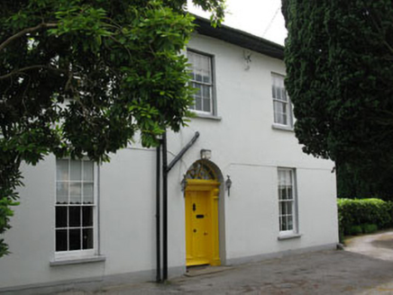 Masseytown HouseHouse · 182 yd
Explorer Tom Masseytown House in Kilnagurteen has a symmetrical façade that looks like it was drawn with a ruler. It’s got tall…
 Sunnyside HouseHouse · 267 yd
Explorer Tom Sunnyside House in Gurteenroe ended up in the wrong place because it got turned around looking for the sun.…
 Macroom CourthouseCourt house · 309 yd
Explorer Tom Macroom Courthouse is a classical building from 1830 that looks exactly like every other courthouse in Munster because…
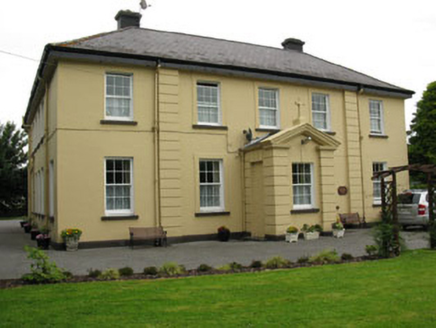 Saint Colman's HousePresbytery/parochial/curate's house · 320 yd
Explorer Tom Saint Colman's House in Gurteenroe is feuding with the next village over who has the better porch. It’s been polishing…
 Bishop McEgan Park, MacroomGAA ground · 612 yd
 Battle of MacroomBattle · 624 yd
Explorer Tom The Battle of Macroom is constantly trying to one-up its more famous cousin next door by claiming it had better weather…
 Tom Creedon Park, MacroomGAA ground · 1174 yd
 Fairy fort / earthen ringfort in BallyveeraneFairy fort / earthen ringfort · 1414 yd
Explorer Tom Fairy fort / earthen ringfort in Ballyveerane has a three-metre inner bank height, which is quite imposing. There’s a…
 Bealick MillVisitor attraction · 1652 yd
Explorer Tom Bealick Mill would teach history like a strict teacher who only uses one-liners and expects you to already know the…
 Fairy fort / earthen ringfort in Sleveen EastFairy fort / earthen ringfort · 1726 yd
Explorer Tom Fairy fort / earthen ringfort in Sleveen East is an oval saucer overlooking two rivers. The stone-faced scarp looks…
More historic places in County Cork · All of County Cork

What do you know about this place?Tap to add a comment or ask a question