
Places near here
Photo credits
- Britishfinance, Wikimedia Commons · CC BY-SA 4.0
- Golfing in Ireland; photographer not stated, Source publisher
- National Inventory of Architectural Heritage
- Kmcnamee, Wikimedia Commons · CC BY-SA 4.0
- The Vicious Chicken of Bristol, Wikimedia Commons · CC BY-SA 4.0
- Schcambo at English Wikipedia, Wikimedia Commons · Public domain
- Oliver Dixon, Wikimedia Commons · CC BY-SA 2.0
Explorer Tom Font in Rosahane has vanished so completely that even the GPS is pretending it never existed. It used to have a slot…
 CroaghanmoiraMountain / peak · 1.3 mi
Explorer Tom Croaghanmoira in County Wicklow would order a triple chipper with extra gravy and refuse to share a single fry with…
Enclosure in CappaghEnclosure · 1.3 miExplorer Tom Enclosure in Cappagh caused the whole parish to argue about who owns it last Tuesday. It’s just a bank in a field, but…
(Site of) Castle LaurenceCastle, unclassified · 2.2 miExplorer Tom Castle Laurence in Ballymanus was built by Sir Laurence Esmond but now it’s just a barn on a slope, which is a bit of a…
 Macreddin Golf ClubGolf course · 2.3 mi
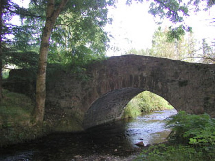 Macreddin BridgeBridge · 2.3 mi
Explorer Tom Macreddin Bridge is a picturesquely sited structure with a wooded backdrop that blends well with its surroundings. It’s…
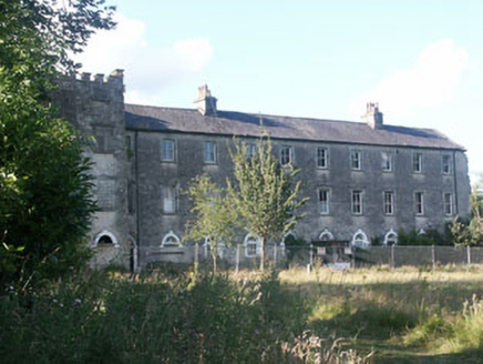 Aghavannagh BarrackBarracks · 2.4 mi
Explorer Tom Aghavannagh Barrack thinks the local rabbits are using it as their personal playground and gym. It’s partly demolished…
 Ballymanus GAAGAA ground · 2.5 miSite of Phelims CastleCastle, tower house · 2.9 mi
Explorer Tom Site of Phelims Castle in Ballinacor is where Phelim O'Byrne supposedly had his stronghold, but now it’s just a slope…
 Battle of GlenmalureMajor battlefield · 4.9 mi
Explorer Tom The Battle of Glenmalure echoes with the sound of sheep complaining about the mud in 1580. Fiach MacHugh O'Byrne…
 CorrigasleggaunMountain / peak · 5.1 mi
Explorer Tom Corrigasleggaun in County Wicklow looks like it was built by someone who really didn't read the instructions properly.…
 Shay Elliott memorialMemorial · 5.3 mi
Explorer Tom Shay Elliott memorial is where a love story went catastrophically wrong next door in 1942. The heartbreak is so potent…
More mountains and hills in County Wicklow · All of County Wicklow

What do you know about this place?Tap to add a comment or ask a question