Places near here
Photo credits
- National Inventory of Architectural Heritage
- A.-K. D., Wikimedia Commons · CC BY-SA 4.0
- Sarah777, Wikimedia Commons · Public domain
- Meinirland.eu, Wikimedia Commons · CC BY-SA 3.0
- Darrin Antrobus, Geograph · CC BY-SA 2.0
- David Purchase, Wikimedia Commons · CC BY-SA 2.0
- kevin higgins, Geograph · CC BY-SA 2.0
- Leendert Moret, Geograph · CC BY-SA 2.0
- Mike Murphy ( talk · contribs ), Wikimedia Commons · CC BY-SA 3.0
- Sitomon, Wikimedia Commons · CC BY-SA 2.0
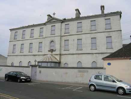 Presentation ConventConvent/nunnery · 14 yd
Explorer Tom Presentation Convent in Maryborough has been swapping costumes from gaol to infirmary like it’s a fashion week. The local sheep have formed a committee and voted unanimously that it looks a bit too fancy for their taste, so they’ve started bleating at it every morning. Try not to make eye contact with the windows if you feel a sudden urge to confess something silly.
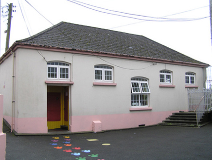 Sacred Heart Primary SchoolSchool · 31 yd
Explorer Tom Sacred Heart Primary School would order a chipper with no salt, only silence, and extra glue for the windows. It still has those high-up windows that block all external views of fun. Have a look and decide if you’d fit in.
 Ridge Grave YardGraveyard · 180 yd
Explorer Tom Ridge graveyard would say it has great stability and long-term vision in a job interview, which is technically true for a hill. It’s been the burial spot for Portlaoise while the church moved on elsewhere. Visit, then text me what you think. I’ll pretend to read it.
 Burial Ridge of MaryboroughMemorial · 203 yd
Explorer Tom Burial Ridge of Maryborough has a hidden message in its stones if you squint hard enough. The plaque is just there to make you feel like you know what’s going on. Bring a friend who talks too much and let the place shut them up.
 Rock of Dunamase, Castle (in Ruins)Castle, Anglo-Norman masonry castle · 3.6 mi
Explorer Tom Rock of Dunamase is the king of the hill who thinks he’s dating royalty but is actually just sitting on a rock with a complicated family tree full of lies. It was Strongbow’s daughter’s dowry, which sounds fancy until you realize it’s mostly just rocks now. Perfect detour when the satnav has a meltdown.
 Rock of DunamaseCastle · 3.6 mi
Explorer Tom The Rock of Dunamase gives Laois a castle on a stone plinth, and I would have chosen the same address if anyone had asked me. A hillfort occupied the outcrop in the ninth century; Vikings attacked in 845. Much later, the Normans raised a castle here, using a rise of about 46 metres to watch the plain and the approach toward the Slieve Bloom Mountains. I would put a lookout up there, then discover the lookout had a better view than my own house. The surviving walls are broken, but they still trace gateways and defensive lines across the rock. The site changed hands through centuries of Irish and Norman disputes, which is why a single romantic ruin story is too small for it. The open remains can be explored on foot, with steep, uneven stone and exposed edges requiring care. Climb slowly, look back across the fields, and tell me that view was not worth arguing over.
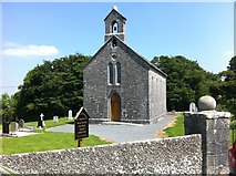 Rock of Dunamase InformationVisitor information · 3.7 mi
Explorer Tom Rock of Dunamase Information in County Laois is where two local families have been feuding over who gets to see the best view since the Stone Age. It’s basically a giant argument with a brochure attached. Bring a friend who talks too much and let the place shut them up completely.
 Aghnahily RingfortArchaeological place · 3.8 mi
Explorer Tom Fairy fort / earthen ringfort in Wolfhill would be the first to dance at a wedding if it weren't so busy pretending it doesn't exist anymore. It’s basically an uninvited guest who forgot its own name and left early. Mind the nettles, they're the real guards here.
 Rock of CashelMountain / peak · 3.8 mi
Explorer Tom Rock of Cashel in County Laois is playing hide-and-seek with me. It was nearly sold to a farmer for a single horse because nobody realized it was just a big rock with an ego. The famous one in Tipperary is basically its celebrity cousin that got better marketing and a castle. Bring your nan, she'll know more than me.
 Morett Castle (in ruins)House, fortified house · 5.2 mi
Explorer Tom Morett Castle has a hidden message in its stones if you squint really hard. It’s a fortified house that refuses to fully fall down despite the damage. Go with someone who loves old stuff and watch them melt.
 Giant Sequoia6.4 mi
Explorer Tom Giant Sequoia in County Laois made map makers sweat because they couldn’t fit it on the page without squashing the mountains. It’s just standing there, smugly taking up all the oxygen. Spot the oldest stone and give it a name.
 European Yew6.5 mi
Explorer Tom European Yew in County Laois has serious trust issues and suspects the postman is stealing its secrets. It stands there looking ancient and slightly offended by modern mail. Have a look and decide if I was lying.
More castles and forts in County Laois · All of County Laois

What do you know about this place?Tap to add a comment or ask a question