
What is recorded here
Ridge Grave Yard stands on an esker ridge outside Portlaoise, holding eighteen and nineteenth century memorials inside a post-medieval stone wall. Local tradition places a lost church behind Mr Brown's shop on the Ridge Road, while the graveyard itself stopped receiving burials in 1897 when the town moved west. The dead have watched the shop, the road and the changing town for centuries, patient and unchanged.
Esker ridge which has been used as a graveyard for the town of Portlaoise, known locally as the 'Ridge Grave Yard'. Described in 1907 as 'an ancient graveyard occupied the site of the 'ridge' near the town, but no trace of a former church now remains on the spot (O'Hanlon and O'Leary 1907, 192). According to local tradition there was a church in the immediate vicinity , viz. At the back of Mr Brown's shop on the Ridge Road (O'Dooley n.d., 5-6) This is the graveyard on the outskirts of Portlaoise town marked on the OS 6-inch maps as the 'Ridge Grave yd.'. The Urban Survey recorded that 'the date of the cemetery is unknown. It is possible that it represents a pre-plantation church site (LA013-102----), perhaps even the church of the Newtown of Leys' (Bradley et. al. 1986, 54). Present remains consist of a narrow long rectangular shaped graveyard (int. dims. 34m N-S; 145m E-W) enclosed by a stone wall of post-medieval date as indicated on current ed. OS 6-inch map. Graveyard contains 18th and 19th century memorials. According to a plaque on the wall of the graveyard this burial ground ceased to be used for burials in 1897 when a new cemetery dedicated to Ss. Peter and Paul in the town of Portlaoise.
Compiled and revised by: Caimin O'Brien
Date of revised upload: 14 May 2015
The monument record does not grant public access. Check the route and ask the landowner before entering private land.
- What survives
- Recorded monument
Places near here
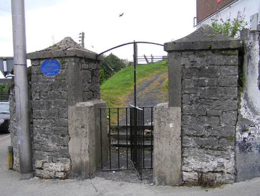 Ridge Graveyardgraveyard/cemetery · 63 yd
 Burial Ridge of MaryboroughMemorial · 63 yd
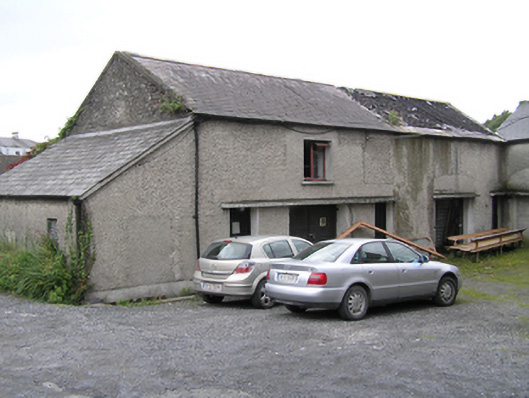 Portleix Houseoutbuilding · 90 yd
 Town defences in MaryboroughTown defences · 130 yd
 ConventCastle, tower house · 180 yd
 Old Barrack, Mill LandCastle, unclassified · 299 yd
 Portlaoise CourthouseMemorial · 464 yd
 Enclosure in Ballyroan (maryborough East By.)Enclosure · 1194 yd
 Rock of DunamaseCastle · 3.5 mi
 Rock of Dunamase InformationVisitor information · 3.6 mi
 Rock of CashelMountain / peak · 3.9 mi
 Giant SequoiaGiant Sequoia · 6.3 mi
Other information
Photo: A.-K. D. · CC BY-SA 4.0