
Places near here
Photo credits
- National Inventory of Architectural Heritage
- Vadim Manuylov, Wikimedia Commons · CC BY-SA 3.0
- dalvenjah on Flickr, Wikimedia Commons · CC BY-SA 2.0
- Nigel Cox, Wikimedia Commons · CC BY-SA 2.0
- N Chadwick, Geograph · Creative Commons Attribution-ShareAlike 2.0
- Espresso Addict, Wikimedia Commons · CC BY-SA 2.0
- Mike Searle, Wikimedia Commons · CC BY-SA 2.0
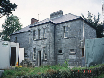 Kenmare Garda Síochána StationRic barracks · 4 yd
Explorer Tom The Kenmare Garda Station boasts about surviving a storm that never actually happened to anyone else. It just wants you to know how tough it is. Find the wonkiest bit and send it to your group chat.
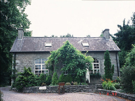 office47 yd
Explorer Tom The Kenmare office started from a bet two lads made after too many pints. They swore it would last a century, and honestly? It’s still standing there smug. Hang around long enough and you'll hear a story from a local.
Mill Cove Gallery / John Brennan StudioGallery · 106 ydExplorer Tom Mill Cove Gallery is dealing with a fairy dispute over parking rights, which has left several artists very annoyed about their canvas space. John Brennan's studio is probably where they keep the magic glue that holds the whole operation together. Stick around for the light changing, it's a show.
Kenmare Heritage Town - Main StreetMemorial · 205 ydExplorer Tom Kenmare Heritage Town - Main Street would say to the place that replaced it, “You’ve got good taste, I’ll admit,” while secretly wishing it was still the busiest road in town. It’s a stretch of history that’s had better days but still knows how to hold its head high in the sunshine. Bring biscuits, every good story needs biscuits.
 Monterey Cypress276 yd
Explorer Tom This Monterey Cypress in County Kerry confused the map makers so badly they gave up and drew a circle. It’s definitely not where you think it is. Tell it a joke, it's been a long time since anyone did.
 Monterey Pine281 yd
Explorer Tom A Monterey Pine in County Kerry claims it was friends with a famous singer who got lost here. The bird population is very skeptical about this story. Go back in winter, it's a different animal.
Man-made underground passage in KenmareMan-made underground passage · 295 ydExplorer Tom Man-made underground passage in Kenmare is playing hide-and-seek on Kenmare Bay. It’s cut from solid rock and slopes down like a secret slide. Imagine it crying on a reality show about poor lighting. Find a local and ask them the real story, then come back and tell me.
Kenmare Tourist Information OfficeVisitor information · 354 ydExplorer Tom Kenmare Tourist Information Office in County Kerry would explain the 1800s to a teenager by saying it was basically the same as now but with worse fashion and more mud. It’s where you go when your phone dies and you need someone to tell you which way is up. Hang around long enough and you'll hear a story from a local.
 Kenmare Stone CircleVisitor attraction · 493 yd
Explorer Tom Kenmare Stone Circle in Kerry is where two villages once fought over something stupid like who had the better turnips, leaving these stones as permanent witnesses to their grudge. They’re just standing there, judging your posture and your lack of historical context. Grand place for a sulk or a snog, your call.
 Graveyard1195 yd
Explorer Tom Graveyard in Killowen would describe the 1800s to a teenager as ‘slow Wi-Fi’. It’s still standing strong while everything else crumbles around it. Visit, then text me what you think. I'll pretend to read it.
 StrickeenMountain / peak · 1.5 mi
Explorer Tom Strickeen was saved by a hero no one remembers because he died of embarrassment from all the wind blowing his hair around. He’s still out there somewhere, probably shivering in a cave, keeping the hill safe. Perfect place to be dramatically windswept.
_(geograph_3037291).jpg/250px-Castles_of_Munster-_Dunkerron,_Kerry_(2)_(geograph_3037291).jpg "Photo: Mike Searle, Wikimedia Commons · CC BY-SA 2.0") Dunkerron CastleCastle · 1.7 mi
Dunkerron CastleCastle · 1.7 miExplorer Tom Dunkerron Castle near Kenmare has four storeys and more changes of owner than I have excuses for being late. Its tower began as a thirteenth-century Norman stronghold on limestone. Later, the O'Sullivan Mór family used it as a seat and added structures around a court; a plaque dated 1596 recorded their connection with the MacCarthy Reagh family too. Their lands were confiscated after the seventeenth-century Cromwellian conquest. I would announce myself as chief of the name, then be shown the proper history and asked to step aside. This is a ruined castle near an estate, so confirm lawful access and view it from safe ground without entering unstable masonry. Notice how the tower and later court work together. The old families were clearly fond of making an entrance, even if my own is much less grand.
More archaeology and monuments in County Kerry · All of County Kerry

What do you know about this place?Tap to add a comment or ask a question