What is recorded here
From OpenStreetMap (© OpenStreetMap contributors) n11758625695
Places near here
Photo credits
- Maker not stated on source page, www.pinterest.com
- Maker not stated on source page, www.dreamstime.com
- Maker not stated on source page, commons.wikimedia.org
- Steve Edge, Wikimedia Commons · CC BY-SA 2.0
- Maker not stated on source page, au.pinterest.com
- National Inventory of Architectural Heritage
- Donal.hunt, Wikimedia Commons · CC BY-SA 4.0
- Maker not stated on source page, en.wikipedia.org
- Shaun Ferguson, Geograph · CC BY-SA 2.0
 Fairy fort / earthen ringfort in DerrymoreFairy fort / earthen ringfort · 1721 yd
Explorer Tom Fairy fort / earthen ringfort in Derrymore is huge enough to host a county fair without anyone complaining about the…
 Cross-inscribed stone in Glebe (iveragh By.)Cross-inscribed stone · 1.9 mi
Explorer Tom Cross-inscribed stone in Glebe sits by a spring well where patterns used to be held on March 3rd. Its New Year's…
 Short CastleArchaeological place · 2.0 mi
Explorer Tom Short Castle in County Kerry is short enough to hide behind a hedge during a zombie apocalypse. It probably just rolled…
 Killinane Church (in ruins)Church · 2.0 mi
Explorer Tom Killinane Church keeps getting picked on by the wind because it won’t admit it’s just a pile of stones. It used to host…
 Cist in Cappagh (iveragh By.)Cist · 2.1 mi
Explorer Tom Cist in Cappagh has an imaginary fan club made entirely of people who found the yew wood sword model back in 1958. They…
 Srugreana AbbeyCountry house · 2.2 mi
Explorer Tom Srugreana Abbey is actually a Victorian house that lied about its religious upbringing for decades. A poet probably…
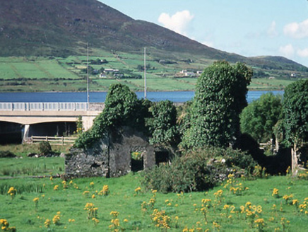 Carhan HouseHouse · 4.2 mi
Explorer Tom Carhan House in Carhan Lower is just a ruin now, but back in 1770 it was fancy. Rumor has it a fox moved in and started…
 O'Connell MonumentMonument · 4.3 mi
Explorer Tom The O'Connell Monument in Carhan Lower makes a suspicious creaking sound at night when the wind hits it right. Alan…
 Standing stone in Cill Na GcolmánStanding stone · 4.5 mi
Explorer Tom Standing stone in Cill Na Gcolmán is secretly the world’s best at keeping its mouth shut about old secrets. It’s got a…
 CastleCastle, unclassified · 4.6 mi
Explorer Tom Castle in Aghatubrid is having a massive row with the nearest tree over who gets to block the view. It’s been shouting…
 Fairy fort / earthen ringfort in Laharan SouthFairy fort / earthen ringfort · 4.6 mi
Explorer Tom Fairy fort / earthen ringfort in Laharan South is nursing a massive grudge against the local weather. It’s barely…
 Emlagh LoopWalking route · 6.6 mi
Explorer Tom Emlagh Loop in County Kerry would order extra gravy and no vegetables if it went to the chipper, which honestly sounds…
More mountains and hills in County Kerry · All of County Kerry

What do you know about this place?Tap to add a comment or ask a question