What is recorded here
Clyrower Old Fence is a linear earthwork in Ballygriffin (Ballygriffin parish), Lisheen (Ballygriffin parish), County Tipperary, Ireland. An account from around 1840 called the fence running southwest from Lisheen House to the River Suir an ancient territorial boundary. The 2011 inventory followed it from the Suir and Multeen confluence through Ballygriffin into Lisheen. It recorded some banks levelled or built into trackways, one section not visible above ground, and the best-preserved part standing 1.5 metres high inside a field boundary.
In improved pasture for duration. Follows close to River Suir from its confluence with the Multeen River to S in Ballygriffin townland and extends to NE into Lisheen townland. At the S end a cliff-edge fort (TS060-074----) is strategically placed within the southern axis of confluence of the Multeen River and the River Suir. Another cliff-edge fort (TS060-071----), located on the SE bank of the River Suir, overlooks this confluence to the SW. According to the OS Namebook (O'Donovan c. 1840), 'From Lisheen House in a south westerly direction to the Suir, runs a fence said to have been an ancient territorial boundary'. The S section, aligned roughly N-S, is visible as the remains of a levelled bank (dims. Wth at top 6m; total Wth 7.9m; H at E 0.05m; H at W 0.07m) which is also defined as a level area (Wth 9m) with a scarp (Wth 1.25m; H 0.17m) on its W-side and an existing hedgerow field boundary to E which is partially incorporated into a farm trackway. A short, but reasonably well preserved bank (Wth at top 2.75m; total Wth 4.5m; H at S 0.2m; H at N 0.15m) extends (long-axis ENE-WSW) at the northern end of this section. The mid-section changes direction, running roughly E-W, the western end is incorporated into a trackway and the eastern end is not visible above ground where a steep, wooded scarp falls from improved pasture at N, to the flood plain of the River Suir to S. The northern section runs NE-SW towards Lisheen House. At the SW-end, the bank (Wth at top 1.3m; total Wth 5.85m; H at E 0.55m; H at W 0.95m) is incorporated into a field boundary. The best preserved section of the monument (max. H 1.5m) survives incorporated into an existing field boundary, though further N the boundary (long-axis NE-SW) appears to have been removed without trace. A short portion of the monument may be incorporated into a field boundary (L c. 72m) S of Lisheen House, where the bank (Wth c. 2.1m; H 0.5m at WNW; H 0.55m at ESE) is aligned with mature trees, with a land drain on the WNW-side.
Compiled by: Jean Farrelly
Date of upload: 26 August 2011
The monument record does not grant public access. Check the route and ask the landowner before entering private land.
- What survives
- Recorded monument
Places near here
 IndicatedEnclosure · 299 yd
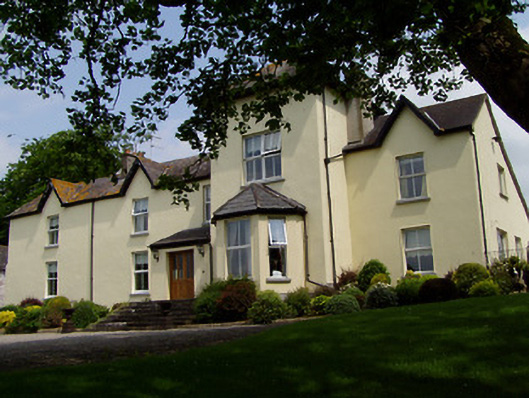 Ballygriffin Househouse · 480 yd
 CastleHouse, fortified house · 494 yd
 Ballygriffin Ch. (in ruins)Church · 574 yd
 Settlement cluster in Ballygriffin (ballygriffin Par.)Settlement cluster · 645 yd
 Castle (in ruins)Castle, tower house · 1599 yd
 European ashEuropean ash · 1.9 mi
 Athassel PrioryHeritage attraction · 2.4 mi
 Hore AbbeyHeritage attraction · 3.6 mi
 Dundrum Woods (Marl Bog)Forest · 4.2 mi
 I.R.A. 3rd. Tipperary Brigade MemorialMemorial · 7.2 mi
 The Maid of ErinMemorial · 8.1 mi