What is recorded here
Clonmeen Castle stands as a seventeenth-century bawn on a plateau edge, its limestone walls and corner towers built to watch the Blackwater River valley and resist invasion. Beneath the newer structure lie thicker foundations from a fourteenth-century stronghold owned by Philip O Mol, marking the site as a long-held anchor for the O'Callaghans before the wars of 1641 broke its line. The gun-loops still pierce the rubble like closed eyes, waiting for a threat that never returns, while the empty pasture inside swallows the footsteps of everyone who ever defended it.
On edge of plateau, overlooking Blackwater River valley to N; deep quarry to W and NW. Rectangular area (84m E-W; 83m N-S) enclosed by limestone rubble curtain walls (H c. 5m) with remains of circular flanking towers at NE, SE and SW corners; traces of foundations of similar tower at NW corner. Level interior in pasture.
Entrance via wide broken ope at W end of S wall and narrow inserted arched gateway near N end of W wall. Site is 17th-century type bawn with numerous gun-loops in bawn walls and in towers; loops have splayed and lintelled embrasures with rectangular shot holes (Wth c. 0.05m; H c. 0.08m). Tower at SE corner (int. diam. c. 4m) is most complete; entrance from within bawn via ground-floor doorway, now ruined; tower wall at ground-floor level pierced by several gun-loops; large joist sockets overhead indicate position of 1st floor. Entrance to SW tower blocked; tower partially collapsed. Entrance to NE tower via inserted steps; tower partially collapsed.
On 1842 OS 6-inch map dotted line outlines rectangular feature (c. 25m E-W; c. 10m N-S), named 'site of Clonmeen Castle', projecting into interior from W curtain wall. This had disappeared by 1897 (Grove White 1905-25, vol. 2. 235-6) and no visible trace of it survives. Foundations of earlier thicker walls under N and E bawn walls and under SE tower may be remains of a castle here referred to in 14th-century document as possession of Philip O Mol (MacCotter and Nicholls 1996, 35).
Clonmeen subsequently one of the principal castles of the O'Callaghans (Ó Murchadha 1985, 67). Said to have been ruined in wars of 1641 after which forfeited by O'Callaghans (Grove White ibid.).
The above description is derived from the published 'Archaeological Inventory of County Cork. Volume 4: North Cork' (Dublin: Stationery Office, 2000). In certain instances the entries have been revised and updated in the light of recent research.
Date of upload/revision: 14 January 2009
Clonmeen Castle was likely built by the Butler family in the 15th or 16th century as part of their efforts to consolidate control over the strategically important Blackwater River valley during the late medieval period. Its location on a plateau provided defensive advantages and oversight of key regional routes.
This remains an important historical record, but the official description says the monument is no longer visible or has been destroyed. The monument record does not grant public access. Check the route and ask the landowner before entering private land.
- What survives
- No visible remains or recorded as destroyed
Places near here
 CastleCastle, unclassified · 38 yd
 St Fursey's WellSpring · 554 yd
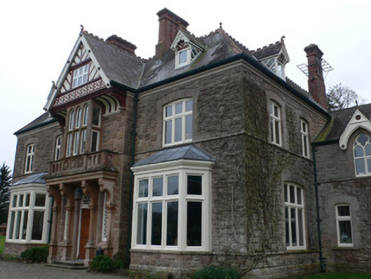 Clonmeen Househouse · 580 yd
 Church in Clonmeen NorthChurch · 609 yd
 Clonmeen Court (Site of)House, fortified house · 711 yd
 IndicatedFairy fort / earthen ringfort · 1092 yd
 TobernaheenaHoly well · 1365 yd
 Mount Hillary - Knightfield LoopWalking route · 1.4 mi
 Mount Hillary - Father Murphy LoopWalking route · 1.6 mi
 Mount HillaryMountain / peak · 2.2 mi
 Kanturk CastleHeritage attraction · 2.4 mi
 Burial ground in AssolasBurial ground · 2.5 mi