What is recorded here
In improved undulating pasture, on a high area of ground. It is named 'Cloghglass' on both the 1840 and 1904 edition OS 6-inch map. Enclosures (TS059-057---- and TS059-059----) are c. 90m to the NE and c. 90m to the SE respectively. The original location of the stone has been quarried, leaving an oval depression (dims. 20m NE-SW; 12m NE-SW; D 1.4m). The limestone standing stone (L 1.15m; 0.7m x 0.5m), now lying prostrate, is located on the N slope of this depression. It tapers towards the top (0.45m x 0.3). The stone is quite weathered, the three exposed faces are generally flat with natural vertical fissures.
Compiled by: Jean Farrelly
Date of upload: 26 August 2011
Likely dating to the Neolithic or Early Bronze Age, Cloghglass is probably associated with ritual or territorial markers common in upland landscapes. Its name, derived from Irish *clogh* (stone) and *glas* (grey or spectral), may reflect local folklore or a sense of an otherworldly presence.
The monument record does not grant public access. Check the route and ask the landowner before entering private land.
- What survives
- Recorded monument
Places near here
 Enclosure in DrishaneEnclosure · 625 yd
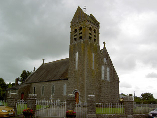 Saint Bridget's Catholic Churchchurch/chapel · 927 yd
 Site of CastleCastle, unclassified · 1181 yd
 DunnasgiathChurch · 1200 yd
 Enclosure in MountwilliamEnclosure · 1300 yd
 Grantstown CastleCastle · 1.3 mi
 Dundrum Woods (Marl Bog)Forest · 2.3 mi
 Maudemount BogWood · 2.4 mi
 Soloheadbeg Ambushambush · 3.7 mi
 Soloheadbeg Ambush SiteMemorial · 3.9 mi
 I.R.A. 3rd. Tipperary Brigade MemorialMemorial · 4.2 mi
 It's a long way to TippereryHeritage attraction · 4.9 mi