Places near here
Photo credits
- National Inventory of Architectural Heritage
- Mike Searle, Wikimedia Commons · CC BY-SA 2.0
- Mike Searle, Geograph · CC BY-SA 2.0
- No machine-readable author provided. Christian1965~commonswiki assumed (based on copyright claims)., Wikimedia Commons · Public domain
- Ruhrfisch, Wikimedia Commons · CC BY-SA 4.0
- Ballyhoura Failte, Wikimedia Commons · CC BY-SA 2.0
- Willow, Wikimedia Commons · CC BY 2.5
- JohnArmagh, Wikimedia Commons · Public domain
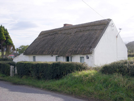 The ThatchHouse · 559 yd
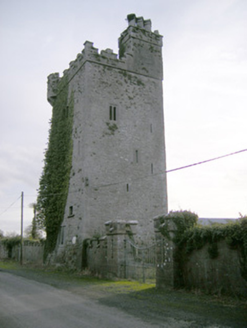 Williamstown CastleCastle/fortified house · 646 yd
Explorer Tom Williamstown Castle in Ballynagarde sounds like a town named after a man who never actually lived there. The name probably means 'Willie’s Town' but he left before the wifi arrived. Find the door that definitely isn’t locked and wave hello.
 Rockstown Castle (in ruins)Castle, tower house · 743 yd
Explorer Tom Rockstown Castle is perched high like a proud peacock on its limestone rock. A cow once tried to buy it, but the price was too steep. Best seen with a hangover and a sausage roll.
Grave YardGraveyard · 939 ydToberauillinSpring · 1497 ydSkool HillMountain / peak · 1651 yd Ballynagarde HouseCastle, tower house · 1750 yd
 Áine and Gearóid Iarla: Lough GurLegend location · 3.7 mi
Explorer Tom Áine and Gearóid Iarla: Lough Gur has a goddess for the lake and a sleeping lord in the old stories. I thought I was coming to admire water and stones. Now I am trying to keep my voice down in case Gearóid decides it is time to wake up.
 Grange Stone CircleArchaeological place · 3.9 mi
 Giants GraveMegalithic tomb · 4.4 mi
Explorer Tom Giants Grave in Ballynagallagh took forty cups of tea to build, if you ask me. The stones lean so hard they're practically falling over into Lough Gur. Go with someone who loves old stuff and watch them melt completely.
 European ash4.8 mi
Explorer Tom European ash is thinking about what the builder was really thinking when they planted it here. It stands quietly in County Limerick, waiting for someone to notice its impressive height. Ideal for a moody photo you'll pretend wasn't posed.
 Monasteranenagh AbbeyHeritage attraction · 5.4 mi
More cliffs, bays and coast in County Limerick · All of County Limerick

What do you know about this place?Tap to add a comment or ask a question