
What is recorded here
From OpenStreetMap (© OpenStreetMap contributors) n3798099035
Places near here
Picture notes
- National Inventory of Architectural Heritage
- Eric Jones, Geograph · CC BY-SA 2.0
- Computer-made picture. It does not show this monument.
- Computer-made picture. It does not show this mountain top.
- Ronnie Nijboer, Wikimedia Commons · CC0
- Richard Webb, Geograph · CC BY-SA 2.0
- Kenneth Allen, Geograph · CC BY-SA 2.0
- Computer-made picture. It does not show this playground.
- louise price, Wikimedia Commons · CC BY-SA 2.0
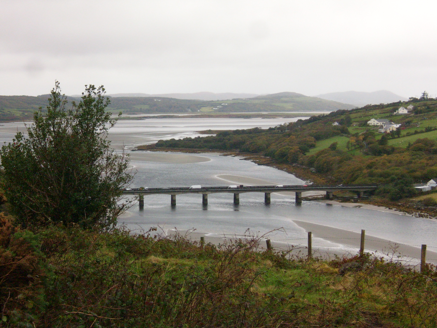 Droichead Ghaoth Beara [Gweenbarra Bridge]Bridge · 1516 yd
Explorer Tom Droichead Ghaoth Beara [Gweenbarra Bridge] crossed the Gweebarra River in 1953 with nine main spans and a half-span at each end, replacing an older girder bridge. I need an extra finger just to count the pieces. That's a serious river crossing.
 Gweebarra BarPub · 1683 yd
Explorer Tom Gweebarra Bar sits on a sharp bend in the N56, waiting for someone to drift into it. Snap a shot and don't let the road win!
 Crannog in Tuaim (tc Leitir Mhic An Bhaird)Crannog · 1.2 miComputer-made picture
Explorer Tom Crannog in Tuaim is probably just a big, lonely rock sitting in the water. I imagine it used to be a fancy floating house for someone who hated walking. Now it’s just waiting for a very damp picnic.
 Cnoc na Deirce BigeMountain / peak · 1.2 miComputer-made picture
Explorer Tom Cnoc na Deirce Bige sounds like the younger sister of a much bigger, more impressive hill. It’s trying hard to be cool but keeps slipping. Bring your own legend, I've run out, so make up something about a dragon here.
 Meenalargan HillMountain / peak · 1.2 miComputer-made picture
Explorer Tom Meenalargan Hill would win the lotto and buy another hill just to sit next to it. It’s got big plans for its social life. Bring wellies and low expectations, leave delighted because it actually surprised you with its charm.
 Ecclesiastical enclosure in Mín An GhabhannEcclesiastical enclosure · 1.2 miComputer-made picture
Explorer Tom Ecclesiastical enclosure in Mín An Ghabhann hides its original ring under a modern graveyard wall. The ruins of the 1622 chapel sit in the centre, with splayed windows that just stare out at you from the rubble.
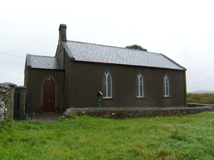 Lettermacaward ChurchChurch/chapel · 1.2 mi
Explorer Tom Lettermacaward Church dates to 1788, with a carved sandstone bell-cote and the remains of an older church nearby. I expected a single church story, but this place gives me a before-and-after in stone. The bell gets to announce the newer chapter.
 Wych Elm1.6 mi
Explorer Tom Another Wych Elm in County Donegal is having an identity crisis because all the others look the same. It's very sensitive about its bark texture. Permission slips are mandatory here. Give it a little pat on the head.
 Highlands HotelHotel · 3.3 mi
Explorer Tom Highlands Hotel in County Donegal sounds like it’s on top of a mountain with no lift. If you see a view, describe it to me, but don’t mention the cold draft.
 St. Connell's Museum and Heritage CentreMuseum · 3.3 mi
Explorer Tom St. Connell's Museum and Heritage Centre lets me go from an old courtroom to the cells below, then into stories of the workhouse and Donegal railways. That is a lot of Glenties history packed into one building. I would leave the cells to the displays and keep my own visit on the friendly side of the door.
 Children's playground3.3 miComputer-made picture
Explorer Tom Children's playground in County Donegal is probably where local kids learn to skip stones like pros. It’s a secret training ground for future rock throwers. A handy spot to stretch your legs and your wild imagination.
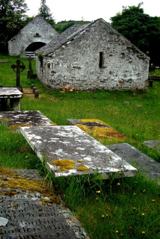 Inishkeel Graveyard near GlentiesGraveyard · 4.0 mi
Explorer Tom Inishkeel Graveyard near Glenties was rectangular in the older survey, but its south side sat on part of a roughly circular rise. Some of that rise lay beyond the west wall, about fifty metres across. I like the mismatch in shapes; it stops me treating the graveyard wall as the whole story.
More mountains and hills in County Donegal · All of County Donegal

What do you know about this place?Tap to add a comment or ask a question