
Places near here
Photo credits
- Picture: Go Visit Inishowen
- National Inventory of Architectural Heritage
- Patrick Mackie, Geograph · CC BY-SA 2.0
- Malcolm Neal, Geograph · CC BY-SA 2.0
- N Chadwick, Wikimedia Commons · CC BY-SA 2.0
- Kay Atherton, Wikimedia Commons · CC BY-SA 2.0
- Michael Dibb, Wikimedia Commons · CC BY-SA 2.0
- MoorsoP, Wikimedia Commons · CC BY-SA 4.0
- Kenneth Allen, Wikimedia Commons · CC BY-SA 2.0
- Rossographer, Geograph · CC BY-SA 2.0
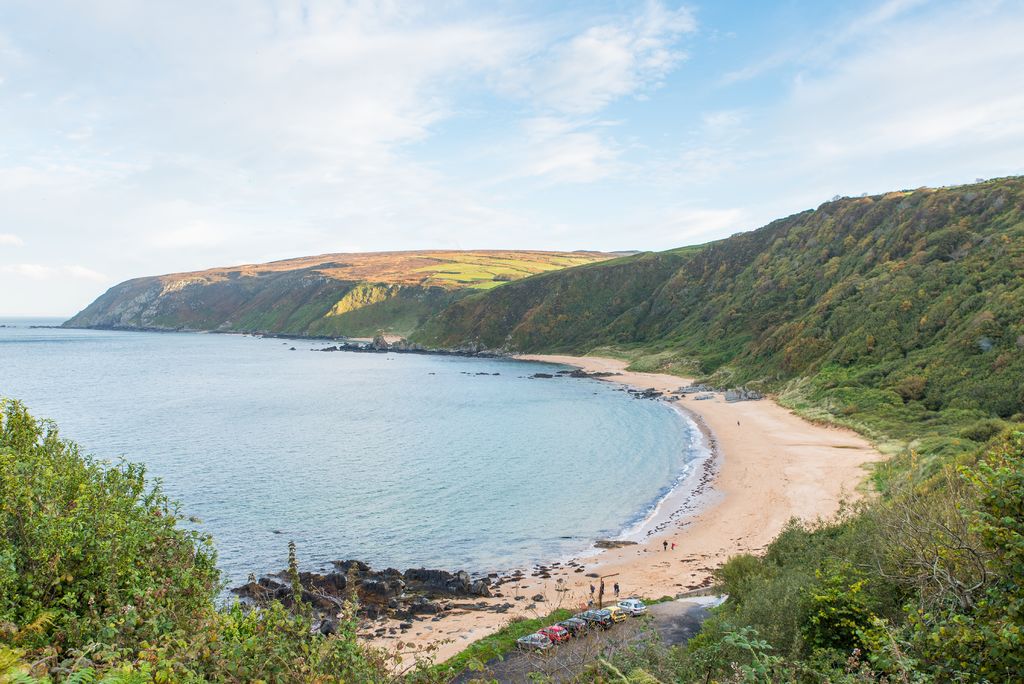 Kinnagoe BayBeach / strand · 1446 yd
Explorer Tom Kinnagoe Bay has an impressive sense of timing. La Trinidad Valencera went down here in 1588, and the wreck waited until 1971 to be found. Nearly four centuries of suspense is rude, frankly. The cove sits below steep slopes, reached by a narrow road with a hairpin bend.
 Rose CottageHouse · 1.5 mi
Explorer Tom Rose Cottage, built around 1855, is standing right where a whole little village used to be before it just vanished off the maps. I reckon the thatch roof is keeping an eye out for those missing neighbors, hoping they pop back in wearing their oldest clothes.
 CrockaulinMountain / peak · 2.0 mi
Explorer Tom Crockaulin offers a lonely triangulation pillar that stares down at Greencastle from a dizzying height. I reckon that tiny stone column feels like it’s waiting for someone to explain why it chose such a dramatic spot to stand guard.
 Michael John's PubPub · 2.6 mi
Explorer Tom Michael John's Pub has two first names, which makes it basically a committee of one. I saw a toucan on the wall, but the car park was empty and quiet. If it's closed, admire it from the road like a polite stalker.
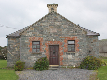 Carrowbeg National SchoolSchool · 2.7 mi
Explorer Tom Carrowbeg National School's building survey found '1873' carved above the door, with the old schoolyard wall and toilet block behind it. The same survey recorded the school building as a house. Even the back yard kept its homework.
 Cliffs, Inishowen HeadPublicly named cliff or headland · 2.8 mi
Explorer Tom Cliffs, Inishowen Head are where a priest once lost a bet and had to walk home in the rain, which explains his permanent grumpiness for centuries. The rock face looks down on us all, judging our fashion choices from up there with zero mercy. Pretend you're a lost aristocrat, nobody will check.
 White StrandBeach / strand · 3.0 mi
Explorer Tom White Strand is secretly incredibly proud of the single potato it found washed up on its shore last Tuesday, treating it like a royal treasure. It keeps polishing that spud with its waves and refusing to let anyone else touch it or comment on it. Give it a pat on the way past, because it’s had a very long life.
 Port a Dorais Cave and Natural DoorSea cave and natural arch · 3.0 mi
Explorer Tom Port a Dorais Cave is incredibly proud of its natural door, which it thinks is far more elegant than any human-made entrance could ever be. It stands there flexing its arch like a bodybuilder showing off his biceps at a beach party, demanding admiration from the sea. Pop by and tell it it’s looking well, because it’ll believe you.
_-_geograph.org.uk_-_5506767.jpg/250px-Grencastle_Fort_(2)_-_geograph.org.uk_-_5506767.jpg "Photo: Michael Dibb, Wikimedia Commons · CC BY-SA 2.0") Greencastle Martello FortCastle · 3.0 mi
Greencastle Martello FortCastle · 3.0 miExplorer Tom Greencastle Martello Fort was built to stop Napoleon from wading in. I can’t help but imagine him slipping on a wet rock and sliding all the way down to Derry with his hat flying off.
 GreencastleCastle · 3.0 mi
Explorer Tom Greencastle was built in 1305 to hold down the North West. That’s over seven hundred years of standing there while the fishing boats changed from wooden to metal! I bet it’s still listening for the clank of old swords.
 Dunagree PointHeadland · 3.1 mi
Explorer Tom Dunagree Point carries the twin granite towers of Inishowen Lighthouse. The lighthouse account says its rear tower was raised by 7.6 metres to improve visibility on Lough Foyle. I can almost hear the headland saying, “I stayed put while the tower did the stretching.”
 Martello tower on magilligan point in Doaghs LowerMartello Tower on Magilligan Point · 4.0 mi
Explorer Tom Martello tower on magilligan point in Doaghs Lower is throwing a century-old tantrum. It claims to be a fortress but looks like a giant's forgotten chimney. Best enjoyed with a bag of chips and no plans whatsoever.
More historic places in County Donegal · All of County Donegal

What do you know about this place?Tap to add a comment or ask a question