DDiscover AloneMapAbout

Cistern in Bailis

Cistern
Computer-made picture that does not show Cistern in BailisNot a photo of this monument
Computer-made picture. It does not show this monument. · Report the wrong picture

What is recorded here

About 25m to the N of the house (ME025-095001-) was a slight hollow (diam. c. 12m; max. D 0.9m at S) that was open to the W, and at the N edge of the excavated area, c. 45m NNW of the house was a cereal-drying kiln (ME025-095003-). In the hollow was a series of pits and channels centred on an E-W ditch (L c. 20m; Wth…

Read the whole record
About 25m to the N of the house (ME025-095001-) was a slight hollow (diam. c. 12m; max. D 0.9m at S) that was open to the W, and at the N edge of the excavated area, c. 45m NNW of the house was a cereal-drying kiln (ME025-095003-). In the hollow was a series of pits and channels centred on an E-W ditch (L c. 20m; Wth 0.6-1.6m; D 0.4-1.2m) that had been widened in its central section and turned SW at its W end. The channel was the last iteration of a medieval drain that extended off to the SW as part of the field system (ME025-095004-). Subsoil was cut deeper on the N side of this trench in the central area, and the pits and channels on this side were cut deeper than those on the S. An elongated pit (dims 4.4m E-W; 0.7m N-S; D 0.8m) on the N side was connected by a channel to a smaller but deeper pit (diam. 1.2m; D 0.4-1.25m) to its W. Another pit (dims 2m x 1.3m; D 0.8m) at the W edge communicated with the E-W channel but was also connected by a separate channel (L 5.4m; Wth 0.4m; D 0.4m) to a smaller pit (diam. 1.2-1.3m; D 0.6m) further N. This channel had been partially back-filled to flow N and was clay-lined to retain water. On the S side of the E-W channel were two shallower pits (dims 2m x 1.5m; D 0.2m: 3m x 2.5m; D 0.4m), the smaller of which was connected with the channel. All these pits had been used for the storage and channelling of water and functioned as cisterns. All the features were backfilled at the same time with a clay deposit that contained animal bone, brick fragments and sherds of post-medieval pottery and glass. (McGlade and Ruddy 2019, 24-29) See the attached plans from McGade and Ruddy 2019 (figs P 33, 24) _01 site plan; _02 Cisterns; Compiled by: Michael Moore Date of upload: 13 April 2023 McGlade, S. and Ruddy, S. 2019 Excavation of Site A, Bailis, & Monitoring Alexander Reid, Navan. Licence: 16E0449. Unpublished report, Archaeology Plan

From the National Monuments Service (Archaeological Survey of Ireland) record ME025-095002

The monument record does not grant public access. Check the route and ask the landowner before entering private land.

What do you know about this place?Tap to add a comment or ask a question

What you write will be public.

Places near here

Photo credits
  • National Inventory of Architectural Heritage
  • 瑞丽江的河水, Wikimedia Commons · CC BY-SA 4.0
  • Rob Hurson, Wikimedia Commons · CC BY-SA 4.0
  • Aubrey Martin, Wikimedia Commons · CC BY-SA 4.0
  • Albert Bridge, Geograph · CC BY-SA 2.0
  • Meath Chronicle; individual aerial photographer not stated, www.meathchronicle.ie
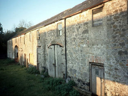
Boyne View HouseFarmyard complex · 1294 yd

Explorer Tom Boyne View House in Athlumney thinks the road leading to it is a bit too busy for its taste, preferring horse carts…

Belmount HouseGates/railings/walls · 1547 yd

Explorer Tom Belmount House gates in Limekilnhill saw a fox take charge of the property last winter and refuse to leave. The…

bridge1558 yd

Explorer Tom Bridge in Athlumney from 1849 would survive a zombie attack by just standing there and letting them trip over its…

Saint Joseph's Convent of MercyHouse · 1606 yd

Explorer Tom Saint Joseph's Convent of Mercy in Athlumney is playing hide-and-seek with me. The stones whisper that the curved bow…

Athlumney CastleCastle, tower house · 1621 yd

Explorer Tom Athlumney Castle is hiding a treasure chest that is definitely just an old biscuit tin from 1974, but don't tell the…
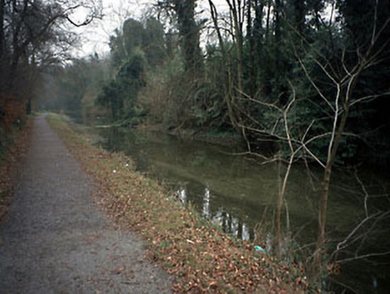
canal (section of)1680 yd

Explorer Tom Canal in Athlumney ended up in the wrong place because someone got their turns mixed up between Navan and Drogheda…

towpath1685 yd

Explorer Tom Towpath in Athlumney is the canal path where a fox once took charge of the whole operation, probably because humans are…

worker's house1716 yd

Explorer Tom Worker's house in Johnstown would survive a zombie attack purely through sheer stubbornness and good bones. It’s too…

CastleCastle, motte · 1723 yd

Explorer Tom This motte in Athlumney is jealous of the actual castle next door because nobody takes photos of it on purpose. It’s…

Donaghmore Round TowerHeritage attraction · 1.6 mi

Explorer Tom Donaghmore Round Tower in County Meath is probably the favourite hangout for local rabbits who use it as their main…

Round Tower1.6 mi

Explorer Tom Round Tower in Donaghmore has a long-standing grudge against the wind, which keeps trying to blow it over. It’s…

Walterstown GAAGAA ground · 2.4 mi

More archaeology and monuments in County Meath · All of County Meath

Add to this placeAdd a picture Add a detailed tip Add a story

Explore the map1,095,414 places to discover

Next place · or swipeBoyne View House