What is recorded here
The corn-drying kiln had been identified in the archaeological testing, and it occupied the N edge of a large cut (max. dims 12.7m N-S; 5.2m E-W; D 0.5m) in the subsoil. It consisted of a stone-lined bulb-shaped pit (int. dims 4.14m E-W; 3.16m N-S; D 0.5m) with an opening to the E where it widens outwards (Wth…
Read the whole record
From the National Monuments Service (Archaeological Survey of Ireland) record ME025-095003
Places near here
Photo credits
- Maker not stated on source page, ms.fusedlearning.com
- Maker not stated on source page, en.wikipedia.org
- National Inventory of Architectural Heritage
- Maker not stated on source page, www.dreamstime.com
- Maker not stated on source page, www.flickr.com
- 瑞丽江的河水, Wikimedia Commons · CC BY-SA 4.0
- Rob Hurson, Wikimedia Commons · CC BY-SA 4.0
 Fairy fort / earthen ringfort in Alexander ReidFairy fort / earthen ringfort · 395 yd
Explorer Tom Fairy fort / earthen ringfort in Alexander Reid sits on a rocky bump, judging everyone. The local bishop refused to…
 Enclosure in AthlumneyEnclosure · 1018 yd
Explorer Tom Enclosure in Athlumney is buried under an IDA Business Park, so there’s definitely a hidden message in its stones if…
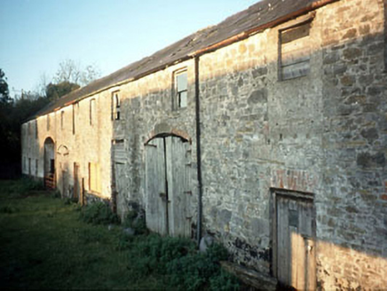 Boyne View HouseFarmyard complex · 1294 yd
Explorer Tom Boyne View House in Athlumney thinks the road leading to it is a bit too busy for its taste, preferring horse carts…
 Saint Mary's CemeteryCemetery · 1411 yd
Explorer Tom Saint Mary's Cemetery in County Meath is currently locked in a screaming match with a fairy over who gets the prime…
 Stone sculpture (present location) in Johnstown (skreen By.)Stone sculpture (present location) · 1478 yd
Explorer Tom Stone sculpture in Johnstown is a pier from Bective Abbey that got moved here because someone had a very strong opinion…
 bridge1544 yd
Explorer Tom Bridge in Athlumney from 1849 would survive a zombie attack by just standing there and letting them trip over its…
 Belmount HouseGates/railings/walls · 1549 yd
Explorer Tom Belmount House gates in Limekilnhill saw a fox take charge of the property last winter and refuse to leave. The…
 Saint Joseph's Convent of MercyHouse · 1598 yd
Explorer Tom Saint Joseph's Convent of Mercy in Athlumney is playing hide-and-seek with me. The stones whisper that the curved bow…
 Athlumney CastleCastle, tower house · 1612 yd
Explorer Tom Athlumney Castle is hiding a treasure chest that is definitely just an old biscuit tin from 1974, but don't tell the…
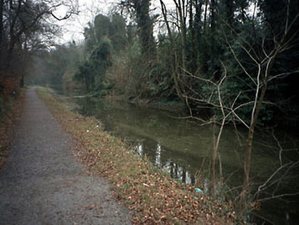 canal (section of)1664 yd
Explorer Tom Canal in Athlumney ended up in the wrong place because someone got their turns mixed up between Navan and Drogheda…
 towpath1669 yd
Explorer Tom Towpath in Athlumney is the canal path where a fox once took charge of the whole operation, probably because humans are…
 CastleCastle, motte · 1716 yd
Explorer Tom This motte in Athlumney is jealous of the actual castle next door because nobody takes photos of it on purpose. It’s…
More historic places in County Meath · All of County Meath

What do you know about this place?Tap to add a comment or ask a question