
What is recorded here
Situated on a slight rise in gently undulating sand dune pasture. Not indicated on any edition of the OS 6-inch map. The account of the discovery of this burial is recorded in a letter to the Keeper of Irish Antiquities at the National Museum of Ireland, dated 14 August 1944, from the Garda Superintendent at Sligo.…
Read the whole record
From the National Monuments Service (Archaeological Survey of Ireland) record SL003-002
Places near here
Photo credits
- Maker not stated on source page, sacredsites.com
- Maker not stated on source page, www.alamy.com
- Maker not stated on source page, www.pinterest.com
- Maker not stated on source page, www.tripadvisor.com
- National Inventory of Architectural Heritage
- Maker not stated on source page, www.dreamstime.com
- N Chadwick, Geograph · Creative Commons Attribution-ShareAlike 2.0
- Oliver Dixon, Wikimedia Commons · CC BY-SA 2.0
- NTF30, Wikimedia Commons · CC BY-SA 4.0
- Maker not stated on source page, fi.pinterest.com
 Anomalous stone group in BunduffAnomalous stone group · 230 yd
Explorer Tom Anomalous stone group in Bunduff is playing hide-and-seek in the dunes. Two slabs stand there like they forgot their…
 Fairy fort / ringfort in BunduffFairy fort / ringfort · 543 yd
Explorer Tom Fairy fort / ringfort in Bunduff is gone because the bishop refused to visit and the ground just gave up on holding its…
 Fairy fort / stone ringfort in BunduffFairy fort / stone ringfort · 660 yd
Explorer Tom Fairy fort / stone ringfort in Bunduff offers a shortcut through its wall that isn’t actually a shortcut, just a very…
 Court tomb in BunduffCourt tomb · 921 yd
Explorer Tom Court tomb in Bunduff would survive Big Brother by just sitting there looking ancient and slightly confused while…
 Megalithic tomb in BunduffMegalithic tomb · 1350 yd
Explorer Tom Megalithic tomb in Bunduff claims to be older than the concept of time itself, which is a wild claim but who can prove…
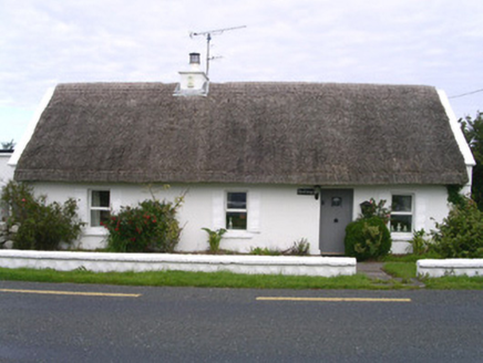 The CottageHouse · 1750 yd
Explorer Tom The Cottage in Creevykeel would order a chipper with extra gravy and call it 'traditional' because the thatch makes…
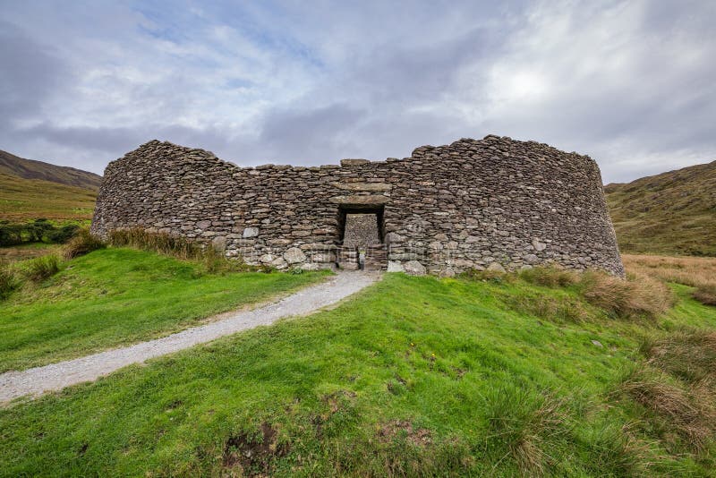 Fairy fort / stone ringfort in CreevykeelFairy fort / stone ringfort · 1.1 mi
Explorer Tom Saint Patrick would have looked at this stone ringfort in Creevykeel and said, 'I came for snakes but found some very…
 Mullaghmore HarbourHarbour/dock/port · 1.2 mi
Explorer Tom Mullaghmore Harbour was nearly sold to a horse trader in 1850 because someone thought the word ‘harbour’ meant ‘stable’…
 Creevykeel Court TombNeolithic court tomb · 1.2 mi
Explorer Tom Creevykeel Court Tomb has been hiding a scandal about which stone was placed first for five thousand years. The locals…
 assassination of Louis Mountbatten, 1st Earl Mountbatten of BurmaAssassination · 1.3 mi
Explorer Tom The Assassination of Louis Mountbatten in County Sligo is haunted by a bird that refuses to leave the memorial, no…
 Gortaway WoodForest · 1.8 mi
Explorer Tom Gortaway Wood is constantly being picked on by the wind because it stands too close to the open moorland for its own…
Culleen WoodForest · 2.0 miExplorer Tom Culleen Wood was once offered to a cow who tried to buy it with three apples and a very confident moo. The farmer…
More archaeology and monuments in County Sligo · All of County Sligo

What do you know about this place?Tap to add a comment or ask a question