
What is recorded here
This cist was uncovered in 1975 during ground works in the garden of a dwelling; the location is now overlain by a farm shed. It was investigated later in that year by Raftery on behalf of the National Museum of Ireland (Licence no. E1045). Rectangular cist (dims. 0.94 ENE-WSW; 0.43m NNW-SSE; H 0.54m) whose sides were…
Read the whole record
From the National Monuments Service (Archaeological Survey of Ireland) record DG021-001
Places near here
Photo credits
- Maker not stated on source page, www.pexels.com
- National Inventory of Architectural Heritage
- Maker not stated on source page, br.pinterest.com
- Maker not stated on source page, www.pinterest.com
- Maker not stated on source page, www.dreamstime.com
- Corinna Schleiffer, Wikimedia Commons · CC BY-SA 2.0
- Richard Webb / Geograph Ireland, www.geograph.ie
 Burial ground in Bredagh GlenBurial ground · 398 yd
Explorer Tom The burial ground in Bredagh Glen is just a rough, overgrown patch that’s about as exciting as a soggy biscuit. Locals…
 Moglass BridgeBridge · 1224 yd
Explorer Tom Moglass Bridge has three arches over the Bredagh River, but the eastern one is a dry arch. Built around 1800, it makes…
 Mapped graveyardGraveyard · 1625 yd
Explorer Tom This graveyard is waiting for its moment in the sun, or rather, the moon, since it’s all about the afterlife here. It…
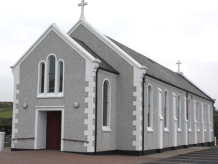 St. John’s Catholic ChurchChurch/chapel · 1653 yd
Explorer Tom St. John’s Catholic Church in Carrowblagh Or Leckemy was built around 1910, and its tripartite window on the front…
 Standing stone in CarrowmenaghStanding stone · 1.1 mi
Explorer Tom Standing stone in Carrowmenagh is a whopping 2.44m tall but only 0.29m thick, which makes it look like a giant’s slice…
 gates/railings/walls1.2 mi
Explorer Tom Gates in Carrowblagh or Leckemy include a wrought-iron field gate with a rolling hinge and its original stone piers.…
 Bredagh Glen Fairy Fort / LisarveFairy fort / ringfort · 1.3 mi
Explorer Tom Bredagh Glen's Lisarve is barely a trace of a circle in the old survey, perched between a stream and the Bredagh River.…
 Fairy fort / earthen ringfort in Carrowblagh or LeckemyFairy fort / earthen ringfort · 1.3 mi
Explorer Tom Fairy fort / earthen ringfort in Carrowblagh Or Leckemy is now 'no trace' of a platform and underground passage…
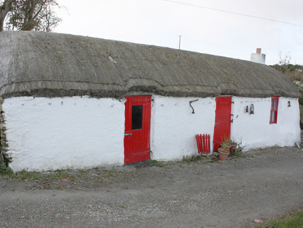 outbuilding1.3 mi
Explorer Tom Outbuilding in Glencrow wears a rounded thatched roof that looks like it’s been carefully wrapped in netting to stop it…
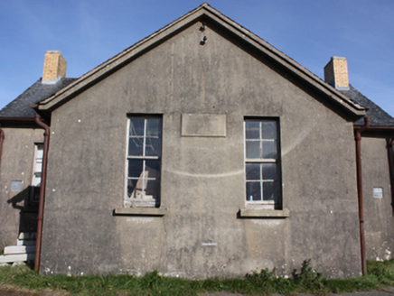 Scoil BhrídeSchool · 1.5 mi
Explorer Tom Scoil Bhríde in Cooly is a former school dated 1931, with two front doors and a wall dividing the rear yard. The…
 CrockavishaneMountain / peak · 1.9 mi
Explorer Tom Crockavishane in Donegal is having a very fancy lunch experience that costs nothing but your dignity. It’s all about…
 Carrick Field, Moville GAAGAA ground · 2.6 mi
More archaeology and monuments in County Donegal · All of County Donegal

What do you know about this place?Tap to add a comment or ask a question