What is recorded here
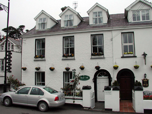
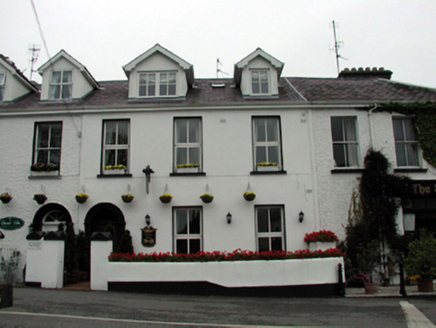
End-of-terrace three-bay two-storey former Royal Irish Constabulary barracks with dormer attic, c.1835, retaining most early fenestration with single-bay two-storey lean-to return to north-west. Renovated and extended, pre-1999, comprising single-bay three-storey return to north-west with dormer attic added to accommodate use as guesthouse. Pitched slate roof (gabled, pre-1999, to dormer attic windows; lean-to to return) with clay ridge tiles, rendered chimney stack, and replacement uPVC rainwater goods, pre-1999, on timber eaves. Painted roughcast walls to front (south-east) elevation with painted replacement cement rendered walls, pre-1999, to remainder. Square-headed window openings (including to dormer attic windows) with stone sills. 2/2 timber sash windows with replacement uPVC casement windows, pre-1999, to return and to dormer attic. Round-headed door opening with moulded archivolt, replacement timber panelled door, pre-1999, and spoked fanlight. Square-headed door openings inserted, pre-1999, to each floor to side (south-west) elevation with glazed uPVC doors. Set back from line of road with stone flagged forecourt, and rendered boundary wall having wrought iron railings over.
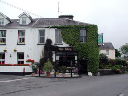
A well-appointed, modest-scale building that is of particular importance for its original intended role as part of a Royal Irish Constabulary barracks complex, representing one of the earliest purpose-built civic buildings in the locality, and which attests to the measures put in place to curtail illegal smuggling activities in Dunmore East in the early nineteenth century. Now accommodating an alternative use, much of the early form and massing nevertheless remains intact, together with a number of important salient features and materials, which significantly enhance the historic quality of the site. The building, together with the remainder in the terrace (including 22817023 – 25/WD-27-17-23 – 25), remains an attractive element of the townscape, prominently positioned at the junction of three roads overlooking the strand area to north, and Dunmore Bay to east.
From the Buildings of Ireland (National Inventory of Architectural Heritage) record 22817026
This does not grant access. Most recorded buildings are privately owned; view them only from public ground unless the owner allows entry.
Places near here
 Ocean ViewRic barracks · 9 yd
 Ric barracks22 ydThe WoodsWalking route · 442 yd
 Harbour and Park walk.Walking route · 505 yd
 Rathmoylan CoveBeach / strand · 2.3 mi
 The White LadyArchaeological place · 2.4 mi
 Ballymacaw CoveBeach / strand · 2.7 mi
 St. Dubhan's ChurchHeritage attraction · 3.2 mi
 hookHeritage attraction · 3.2 mi
 Slade CastleCastle, tower house · 3.8 mi
 Slade CastleHouse, fortified house · 3.8 mi
 Windmill (in Ruins)Windmill · 4.4 mi
Pictures: National Inventory of Architectural Heritage; Paul O'Farrell, Geograph · CC BY-SA 2.0; David Hawgood, Geograph · CC BY-SA 2.0; JackStonePGD, Wikimedia Commons · CC BY-SA 3.0; kevin higgins, Geograph · CC BY-SA 2.0; Andreas F. Borchert, Wikimedia Commons · CC BY-SA 4.0; Alex Passmore, Geograph · CC BY-SA 2.0; Michael Dibb, Geograph · CC BY-SA 2.0; Ianfhunter, Wikimedia Commons · CC BY-SA 4.0; Mike Searle, Geograph · CC BY-SA 2.0
More historic places in County Waterford · All of County Waterford
What do you know about this place?