What is recorded here
Located towards the bottom of a N-facing slope. This is the parish church of Ringagoragh within a rectangular graveyard defined by masonry walls (dims c. 50m E-W; c. 45m N-S), although the graveyard is extended to the W and S (dims c. 100m E-W; c. 60m N-S). This is a nave and chancel church, of which only the pointed chancel arch (Wth 1.95m) and the adjacent part of the S nave wall (int. L 9.3m) survive. Opposing holes (dims. 14cm x 13cm) placed high on the piers of the chancel arch may have supported a rood screen. A round-headed sandstone window (H 0.68m; Wth 0.17-0.19m) in a lintelled embrasure with dressed sandstone ingoings is towards the E end of the S nave wall. The site of St Nicholas’ Well (WA036-007----), where patterns were held on December 6th until c. 1830, is c. 70m to the NE and an earthwork site (WA036-006----) is c. 130m to the N. Archaeological testing (05E0329) over a large area (dims. c. 180m N-S; c. 160m E-W) immediatel S of the graveyard failed to produce any related material (Janes 2008e). (Power 1898a, 198-200)
Janes, T. (2008e) Shanacloon: No archaeological significance. in I. Bennett (Ed.) Excavations 2005: summary accounts of excavations in Ireland, 364, No. 1499. Wordwell. Dublin.
Power, Rev. P. (1898a) Ancient ruined churches of Co. Waterford, WAJ 4, 83-95, 195-219.
The above description is derived from the published 'Archaeological Inventory of County Waterford' (Dublin: Stationery Office, 1999). In certain instances the entries have been revised and updated in the light of recent research.
Date of upload/revision: 6th October, 2011
Compiled by: Michael Moore
The monument record does not grant public access. Check the route and ask the landowner before entering private land.
- What survives
- Recorded monument
Places near here
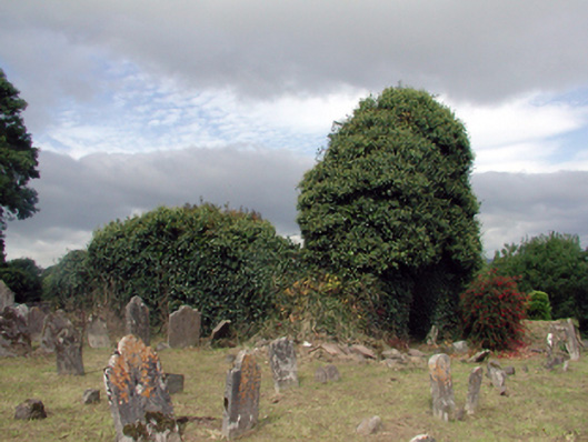 Saint Nicholas's Church (Ringagonagh)graveyard/cemetery · 1 yd
 St Nicholas WellHoly well · 87 yd
 MoteMound · 156 yd
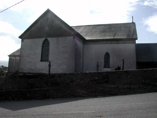 Séipéal San Niocláis [Saint Nicholas's Catholic Church]church/chapel · 408 yd
 Erin's Hope 1867Memorial · 1.7 mi
 Tobar Uí GríobtháinSpring · 1.8 mi
 Ceann HeilbhicHeadland · 2.0 mi
 Cunnigar PointHeadland · 2.8 mi
 Dungarvan World War I MemorialMemorial · 3.1 mi
 Dungarvan Castle (in Ruins)Castle, Anglo-Norman masonry castle · 3.1 mi
 Dungarvan CastleCastle · 3.1 mi
 Waterford County MuseumMuseum · 3.1 mi