What is recorded here
Located at the bottom of a S-facing slope with a canalised W-E stream c. 15m to the N, and the stream turns S c. 80m to the E. This is probalby a chapel-of-Ease in Mocollop parish. The E gable (int. L 6.26m) of a church with the remains of a 15th-century, twin-light tracery window survive. At the N end of the gable, at ground level, is a projecting, stone-roofed chamber (int. dims. 1.66m E-W; 1.45m N-S) with three musket loops and a light. The E end of the N wall (L c. 9m; T c. 1m; H c. 2.7m) survived c. 1840, and is described by J. O'Donovan as having the base of a window (Wth c. 0.7m) c. 1.2m from the E end (O'Flanagan 1929, 69-70). There is no evidence of an enclosure or of burial associated with the church. (Power 1898a, 217-19; 1938a, 67)
O'Flanagan, M. (Compiler) (1929) Letters containing information relative to the antiquities of the county of Waterford collected during the progress of the Ordnance Survey in 1841. Typescript. Bray.
Power, Rev. P. (1898a) Ancient ruined churches of Co. Waterford, WAJ 4, 83-95, 195-219.
Power, Rev. P. (1938a) Some old churches of Decies, JRSAI, 68, 55-68.
The above description is derived from the published 'Archaeological Inventory of County Waterford' (Dublin: Stationery Office, 1999). In certain instances the entries have been revised and updated in the light of recent research.
Revised by: Michael Moore
Date of upload: 10 August 2011
The monument record does not grant public access. Check the route and ask the landowner before entering private land.
- What survives
- Recorded monument
Places near here
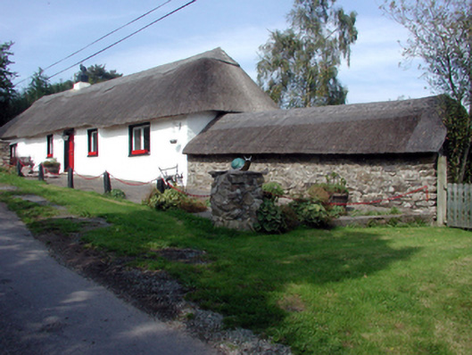 The Old Forgehouse · 225 yd
 Okyle HouseOfficially recorded historic building · 523 yd
 Tobar a TuraisHoly well · 777 yd
 CastleCastle, tower house · 1411 yd
 IndicatedEnclosure · 1429 yd
 Kilnacarriga Castle (in ruins)Castle, unclassified · 1.4 mi
 Deerpark WoodWood · 1.7 mi
 Dromona HillMountain / peak · 2.0 mi
 Dromore WoodWood · 2.4 mi
 Ambrose Power MemorialMemorial · 3.9 mi
 Lady Louisa's WalkWalking route · 3.9 mi
 LismoreMemorial · 4.0 mi