What is recorded here
Located on the W bank of the N-S Blackwater River. This is a rectangular tower house (ext. dims. c. 12.5m E-W; c.10.35m N-S) with a base-batter (max. H 2.5m) and cut-stone quoins partly surviving to the first floor. The remains of newel stairs at the SW angle and a garderobe chute in the E wall survive at first-floor level. There is no evidence of vaulting. Revised by: Michael Moore
Date of upload: 10 August 2011
From the National Monuments Service (Archaeological Survey of Ireland) record WA029-033
The monument record does not grant public access. Check the route and ask the landowner before entering private land.
- What survives
- Recorded monument
Places near here
Photo credits
- Mike Searle, Wikimedia Commons · CC BY-SA 2.0
- National Inventory of Architectural Heritage
- Hywel Williams, Wikimedia Commons · CC BY-SA 2.0
- E. H. (E. Hayden), Wikimedia Commons · Public domain
- Mac McCarron, Geograph · CC BY-SA 2.0
- Jonathan Thacker, Geograph · CC BY-SA 2.0
- N Chadwick, Geograph · Creative Commons Attribution-ShareAlike 2.0
- Sitomon, Wikimedia Commons · CC BY-SA 2.0
- Haydn.hammerton, Wikimedia Commons · CC BY-SA 4.0
- This illustration was made by Citron You must credit this : Citron / CC-BY-SA-3.0, Wikimedia Commons · CC BY-SA 3.0
- Matthew Chadwick, Geograph · Creative Commons Attribution-ShareAlike 2.0
- Dave Spencer, Geograph · CC BY-SA 2.0
 Camphire HouseCountry house · 30 yd
 pier/jetty360 yd
 Ogham StonesOgham stone · 1.2 mi
_(cropped).jpg/250px-Strancally_Castle,_1834_(IA_jstor-30004451)_(cropped).jpg "Photo: E. H. (E. Hayden), Wikimedia Commons · Public domain") Strancally CastleCastle · 1.6 mi
Strancally CastleCastle · 1.6 mi Lady Louisa's WalkWalking route · 4.4 mi
 Ambrose Power MemorialMemorial · 4.4 mi
 St. Carthaghs WellHoly well · 4.4 mi
 European Yew4.5 mi
 Lismore CastleGates/railings/walls · 4.5 mi
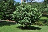 Delavay's magnolia4.5 mi
 Lismore CastleOfficially recorded historic building · 4.6 mi
 Lismore CastleCastle, Anglo-Norman masonry castle · 4.6 mi
More castles and forts in County Waterford · All of County Waterford
What do you know about this place?