
What is recorded here
In grassland, in flat pasture on a N-facing slope of the Slieveardagh Hills with a panoramic views from W through N to E. A tower house (TS048-026001-) lies 100m to the NE, and the ruins of an 18th-century house are nearby to the NW. The church consists of a simple rectangular building (int. dims. 6.75m N-S; 13m E-W;…
Read the whole record
From the National Monuments Service (Archaeological Survey of Ireland) record TS048-026002
Places near here
Photo credits
- Maker not stated on source page, en.wikipedia.org
- Mike Searle, Geograph · CC BY-SA 2.0
- Maker not stated on source page, www.adequatetravel.com
- National Inventory of Architectural Heritage
- Maker not stated on source page, ru.pinterest.com
- Maker not stated on source page, uk.pinterest.com
- Maker not stated on source page, www.flickr.com
- Maker not stated on source page, www.dreamstime.com
- Maker not stated on source page, www.pinterest.com
 Mellisson CastleSettlement cluster · 43 yd
Explorer Tom Mellisson Castle is perched on a natural rock outcrop with panoramic views, but the actual castle seems to have gone…
 Littlefield HouseCountry house · 1.2 mi
Explorer Tom Littlefield House in Littlefield caused such a huge parish argument that it lost its roof and still doesn't care. It’s…
 Glengoole Church CemeteryGraveyard · 1.3 mi
Explorer Tom Glengoole Church Cemetery was allegedly designed by a mother-in-law who wanted every single path to be exactly three…
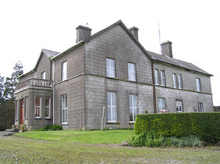 Coalbrook HouseCountry house · 1.6 mi
Explorer Tom Coalbrook House in Coalbrook is showing off its uneven gables like they’re high fashion, which is a bold move for a…
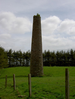 Earlshill CollieryChimney · 1.6 mi
Explorer Tom Earlshill Colliery chimney in Earlshill is so tall and lonely that the Vikings got lost looking for it and ended up in…
 Buolick Church RuinArchaeological place · 2.0 mi
Explorer Tom Buolick Church Ruin is the victim of a bad poem someone wrote about it in 1994, and it has never really recovered from…
 Castle (in ruins)Castle, tower house · 2.0 mi
Explorer Tom The Buolick tower house would handle a nosey neighbour by just pretending not to be there anymore. It was built in 1452…
 Clonamicklon Castle (ruins)Castle · 2.1 mi
Explorer Tom Clonamicklon Castle gave up meat for Lent but accidentally ate a whole sheep during the Easter party. It’s trying to…
Clonamicklon Castle (in ruins)House, fortified house · 2.1 miExplorer Tom Clonamicklon Castle in Clonamicklon is a fortified house that seems to be hiding from its own fame. John Butler built…
 Church in KilbraughChurch · 2.1 mi
Explorer Tom Church in Kilbraugh has been hiding a scandal for centuries that involves someone stealing the roof tiles and selling…
 Graveyard in Glengoole NorthGraveyard · 2.2 mi
Explorer Tom Graveyard in Glengoole North is where smugglers hid their best whiskey before they got caught by a suspicious shepherd.…
 Site of ChurchChurch · 2.2 mi
Explorer Tom Site of Church in Glengoole North would tell its younger self to stop worrying about the bog and start enjoying the…
More historic places in County Tipperary · All of County Tipperary

What do you know about this place?Tap to add a comment or ask a question