
What is recorded here
From the National Monuments Service (Archaeological Survey of Ireland) record DG084-001013
Places near here
Photo credits
- Maker not stated on source page, en.wikipedia.org
- louise price, Wikimedia Commons · CC BY-SA 2.0
- Maker not stated on source page, uk.pinterest.com
- louise price, Geograph · CC BY-SA 2.0
- National Inventory of Architectural Heritage
- louise price, Geograph · Creative Commons Attribution-ShareAlike 2.0
- Maker not stated on source page, commons.wikimedia.org
- Maker not stated on source page, ru.pinterest.com
- Kenneth Allen, Geograph · CC BY-SA 2.0
- Donegal Daily (publisher); individual photographer not stated, www.donegaldaily.com
 Disert Early Church EnclosureEcclesiastical enclosure · 1 yd
Explorer Tom Disert Early Church Enclosure is mostly hidden by grass, with only a few stones marking the edge of what was likely a…
 Disert GraveyardGraveyard · 20 yd
Explorer Tom Disert Graveyard is a D-shaped pocket inside two larger enclosures, with at least 34 low uninscribed grave markers…
 Disert EnclosureEnclosure · 26 yd
Explorer Tom Disert Enclosure is basically a backyard office where the dead keep their own little graveyard section. A drystone wall…
 CarnaweenMountain / peak · 1.2 mi
Explorer Tom Carnaween has Diarmuid Ó Duibhne hiding in its name, at least in the old local telling. There was even a…
 Cloghmeen HillMountain / peak · 1.5 mi
Explorer Tom Cloghmeen Hill is having a quiet rivalry with Slieve League because it’s tired of being the understudy in every photo…
 Church of the Holy RedeemerChurch/chapel · 2.8 mi
Explorer Tom Church of the Holy Redeemer has a bell donated in 1934 by the Revd. Daniel S. Sheerin for his parents. I bet he rang it…
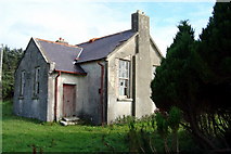 Lettermore National SchoolSchool · 2.8 mi
Explorer Tom Lettermore National School is where a teacher once smuggled a whole crate of chocolates using a hollowed-out textbook.…
 O'Neils PubPub · 3.0 mi
Explorer Tom O'Neils Pub in County Donegal is probably full of people talking about the weather. No address provided, so it might be…
 Mapped graveyardGraveyard · 4.7 mi
Explorer Tom The most dramatic thing to ever happen at this unmapped graveyard was a pigeon landing on a headstone with suspicious…
 GlentiesHostel · 5.7 mi
Explorer Tom Glenties Hostel is where you sleep in a bed that has seen far too much drama already. Bring an earplug because snoring…
 St. Connell's Museum and Heritage CentreMuseum · 5.7 mi
Explorer Tom St Connell's Museum in Glenties makes an old courthouse speak about Donegal lives, from railway journeys to the people…
 Davy Brennan Memorial ParkGAA ground · 6.0 mi
More historic places in County Donegal · All of County Donegal

What do you know about this place?Tap to add a comment or ask a question