What is recorded here
Church in Croaghan has walls barely sixty centimetres high and a perfectly definite doorway. You could step over the side, but then the whole parish would know you were reared without manners.
Situated on a slight rise with rock outcrop in an undulating landscape. A small rectangular structure (int. dims 6.3m E-W; 5m N-S) with a doorway (Wth 1.35m) at W is defined by a double-faced stone walls (Wth 0.8m; max. H 0.6m) and is known locally to have been a Mass-station. It is probably the Tassan mass-rock (Ó Gallachair 1957, 114).
From the National Monuments Service (Archaeological Survey of Ireland) record MO014-036
The monument record does not grant public access. Check the route and ask the landowner before entering private land.
- What survives
- Recorded monument
Places near here
Photo credits
- Brian Lenehan, Geograph · Creative Commons Attribution-ShareAlike 2.0
- National Inventory of Architectural Heritage
- Kenneth Allen, Geograph · CC BY-SA 2.0
- James O'Neill, Wikimedia Commons · CC BY-SA 4.0
- Wanfried-Dublin, Wikimedia Commons · CC BY 4.0
- Sean Davis, Geograph · CC BY-SA 2.0
- Dean Molyneaux, Wikimedia Commons · CC BY-SA 2.0
- Eric Jones, Geograph · CC BY-SA 2.0
- Shane Killen, Wikimedia Commons · CC BY-SA 2.0
 Saint Michael's Catholic ChurchChurch/chapel · 1724 yd
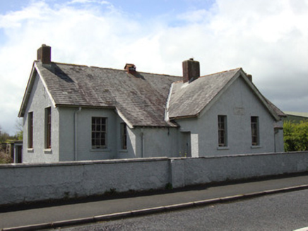 Annyalla National SchoolSchool · 1.0 mi
 Monaghan WayWalking route · 2.3 mi
 Battle of ClontibretBattlefield · 3.4 miMonaghan WayWalking route · 3.5 miJohn Francis GreenMemorial · 3.5 mi
 Portal tomb in LennanPortal tomb · 3.6 mi
 Multiperiod Church, Graveyard & Enclosure: Derrynoose Old Church, Lisrocatty, Lysreakeilte, Listrakelt, St. Mochua's in ListarkeltMultiperiod Church, Graveyard & Enclosure: Derrynoose Old Church, Lisrocatty, Lysreakeilte, Listrakelt, St. Mochua's · 4.1 mi
 Blaney CastleCastle · 4.3 mi
 Mullyash MountainMountain / peak · 4.4 mi
 Lough MucknoLake and park landscape · 4.7 mi
 Crane IslandIsland · 5.7 mi
More historic places in County Monaghan · All of County Monaghan
What do you know about this place?