
What is recorded here
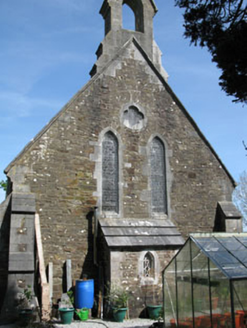
Freestanding Church of Ireland church, built c.1780, comprising three-stage entrance tower to front (west) with flanking porches, four-bay nave and apse to rear (east). Now ruinous and roofless. Dressed stone eaves course to nave and apse having rendered crenellated parapets to tower and porches with rendered…
Read the whole record
From the Buildings of Ireland (National Inventory of Architectural Heritage) record 20907230
Places near here
Photo credits
- Donal.hunt, Wikimedia Commons · CC BY-SA 4.0
- National Inventory of Architectural Heritage
- MrCorman, Wikimedia Commons · CC BY-SA 4.0
- Aghabullogue GAA / EchoLive source; photographer not named, www.echolive.ie
- Maker not stated on source page, ie.polomap.com
- Maker not stated on source page, tr.pinterest.com
- Maker not stated on source page, www.dreamstime.com
- Corkonian2013, Wikimedia Commons · CC BY-SA 3.0
- Frederick Dean, Geograph · CC BY-SA 2.0
 Church (in Ruins)Church · 9 yd
Explorer Tom Church in Glebe has an unusually fancy tower that looks like it's wearing a tiny hat. The map makers got this one…
 Church in Glebe (muskerry East By.)Church · 71 yd
Explorer Tom Church in Glebe is the older sibling that got tired of the noise and moved out long ago. It suspects the postman stole…
 church/chapel73 yd
Explorer Tom The church in Glebe sits on a hill like it's judging everyone below. It's got stained glass that probably costs more…
 St Patrick's Roman Catholic ChurchChurch/chapel · 306 yd
Explorer Tom St Patrick's Roman Catholic Church has a long-standing grudge against the weather for making it look so imposing…
 Coachford, AghabullogueGAA ground · 563 yd
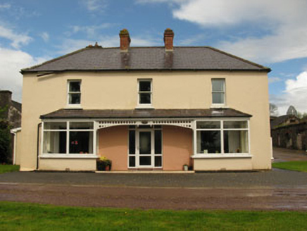 LeemountHouse · 856 yd
Explorer Tom Leemount has some dark history involving Lady Lindsey and an IRA ambush. She tipped off the army and lost her house in…
 ClassasCountry house · 1086 yd
Explorer Tom Classas would survive a zombie attack by locking its walled garden and using the carriageway as a moat of pure…
 Coachford CemeteryCemetery · 1193 yd
Explorer Tom Coachford Cemetery in County Cork has an imaginary twin across the sea that keeps sending postcards. They argue about…
 Holy Well (Site of)Holy well · 1.8 mi
Explorer Tom Holy Well in Mahallagh isn’t even shown on the old maps, but people used to perform 'rounds' here near a standing stone…
 Anomalous stone group in DromatimoreAnomalous stone group · 1.9 mi
Explorer Tom Anomalous stone group in Dromatimore has three reddish stones, one of which is missing its capstone or dignity. A…
 Mullinhassig WoodWood · 2.2 mi
Explorer Tom Mullinhassig Wood hides a waterfall beside the Glashagarriff River, a few kilometres from Coachford, and its Irish name…
 Mullinhassig WaterfallWaterfall · 2.3 mi
Explorer Tom Mullinhassig Waterfall hides in a small Cork woodland near Coachford, where the Glashagarriff River cuts between rock…
More historic places in County Cork · All of County Cork

What do you know about this place?Tap to add a comment or ask a question