What is recorded here
Located at the S end of a small N-S ridge. At the centre of the early church site (MO008-011----) is a rectangular grass-covered area (dims c. 20m NE-SW: c. 15m NW-SE) defined by field walls at NW and SW and occasional stones on the line of the perimeter elsewhere. This is the burial ground that was thought to have been used exclusively for children after c. 1800 (Smyth 1953, 63) but there are no grave-markers. A shallow drainage trench dug across it N-S during 1983 unearthed bones and a fragment of a decorated shaft of a high cross (MO008-011003-) that is now in the County Monaghan Museum, but two bullaun stones (MO0008-011004-) and the base of a cross (MO008-011005-) are missing from the burial ground. (Brindley 1988, 49-50)
The above description is derived from the published 'Archaeological Inventory of County Monaghan' (Dublin: Stationery Office, 1986).
Revised by: Michael Moore
Date of upload: 30 August 2017
The monument record does not grant public access. Check the route and ask the landowner before entering private land.
- What survives
- Recorded monument
Places near here
 Not indicatdCross, High cross · 4 yd
 Ecclesiastical enclosure in SellooEcclesiastical enclosure · 14 yd
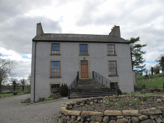 Kilcorran Househouse · 1537 yd
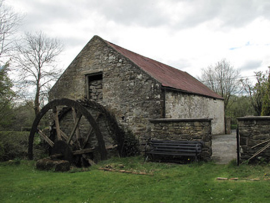 Drummans Millmill (water) · 1.3 mi
 Rough HillMountain / peak · 2.6 mi
 Jaundice WellSpring · 3.2 mi
 Sliabh Beagh Hotel and Tourism CentreVisitor information · 3.9 mi
 Western RedcedarWestern Redcedar · 4.2 mi
 Hazel WoodWood · 4.2 mi
 Roosky Castle (Site of)Castle, ringwork · 4.3 mi
 Lisarrilly HillMountain / peak · 4.4 mi
 Dagda's CauldronHeritage attraction · 5.4 mi