What is recorded here
On a S-facing slope to the N of the public road from Killinaboy to Leamaneh and to the N of an overgrown stile in the wall. Named ‘Chair’ on the 1840 OS 6-inch map and named ‘Seehaun Inneenboy’ on the 1916 ed. Listed as 'Potential site - name’ in the RMP (1996). Described by Westropp (1900, 407) as ‘the seat of…
Read the whole record
From the National Monuments Service (Archaeological Survey of Ireland) record CL016-059
Places near here
Photo credits
- Night of the Big Wind, Wikimedia Commons · CC BY-SA 3.0 nl
- Maker not stated on source page, commons.wikimedia.org
- Maker not stated on source page, en.wikipedia.org
- Maker not stated on source page, www.pinterest.com
- Martin Kerans, Geograph · CC BY-SA 2.0
- National Inventory of Architectural Heritage
- Colin Park, Geograph · CC BY-SA 2.0
- N Chadwick, Geograph · CC BY-SA 2.0
- Andreas F. Borchert, Wikimedia Commons · CC BY-SA 4.0
- Maker not stated on source page, www.dreamstime.com
 Cross in RoughanCross · 314 yd
Explorer Tom Cross in Roughan, County Clare would win the lotto and buy a bigger hill to stand on. It’s currently just a fragment…
 Court tomb in BallycasheenCourt tomb · 605 yd
Explorer Tom The Court tomb in Ballycasheen suspects the postman has been stealing its capstones and hiding them in the valley…
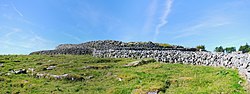 Fairy fort / stone ringfort in CaherfaddaFairy fort / stone ringfort · 703 yd
Explorer Tom Fairy fort in Caherfadda sits on low ground looking all smug about it. I bet there’s a hidden treasure down there…
Fairy fort / stone ringfort in Caherblonick NorthFairy fort / stone ringfort · 1316 ydExplorer Tom Fairy fort / stone ringfort in Caherblonick North smells like old rain and ancient secrets, or at least that’s what I’m…
 CastleCastle, unclassified · 1353 yd
Explorer Tom Castle Ballycasheen in County Clare was left to Teige by his dad, who clearly had a sense of humour. The dog that…
 Cist in DrummoherCist · 1572 yd
Explorer Tom Cist in Drummoher is hiding a treasure that is definitely not gold, but rather a very old biscuit tin from 1890 that…
 Leamaneh Castle (in ruins)Castle, tower house · 1.4 mi
Explorer Tom Leamaneh Castle in Leamaneh North is showing off its five-storey ego again, thinking it’s too good for the locals. It…
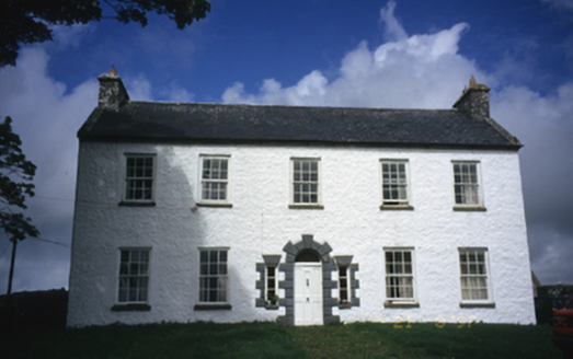 Hollywell HouseFarm house · 4.0 mi
Explorer Tom Hollywell House in Maryville, County Clare, had its top floor chopped off around 1910 because it got too tall for its…
 Burren Centre KilfenoraVisitor information · 4.5 mi
Explorer Tom The Burren Centre in Kilfenora is a sensible first stop before trying to make sense of north Clare's limestone hills. I…
 High CrossHeritage attraction · 4.5 mi
Explorer Tom This High Cross had a moment where a fox took charge of the whole site, sitting on top of it looking like a tiny…
 Saint Fachtnan's CathedralCathedral · 4.5 mi
Explorer Tom Saint Fachtnan's Cathedral in Kilfenora is a Church of Ireland cathedral built from 1170 to 1200, incorporating even…
 Graveyard in KilcarraghGraveyard · 4.8 mi
Explorer Tom Graveyard in Kilcarragh only has one stone, so if you drop your phone there, that’s officially it for the whole place.…
More historic places in County Clare · All of County Clare

What do you know about this place?Tap to add a comment or ask a question