
What is recorded here
From the National Monuments Service (Archaeological Survey of Ireland) record WM017-031001
Places near here
Photo credits
- National Inventory of Architectural Heritage
- Maker named on the Wikimedia Commons picture page · CC BY-SA 2.5
- Alvesgaspar, Wikimedia Commons · CC BY-SA 3.0
- Jamesco101, Wikimedia Commons · CC BY-SA 4.0
- Mike Searle, Geograph · CC BY-SA 2.0
- Christopher Hilton, Wikimedia Commons · CC BY-SA 2.0
- Arno-nl, Wikimedia Commons · CC BY-SA 4.0
- Kieran Campbell, Geograph · CC BY-SA 2.0
- AndreasDelp, Wikimedia Commons · CC BY-SA 4.0
 Rathcastle HouseHouse · 64 yd
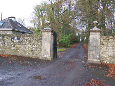 Mearscourt HouseDemesne walls/gates/railings · 589 yd
 gates/railings/walls1288 yd
 Sessile Oak3.1 mi
 Common Lime4.1 mi
Explorer Tom Common Lime took about forty-seven cups of tea to build, according to my totally reliable sources. It stands there looking like it hasn't slept since 1800. Snap one photo, then put the phone away and actually look.
 Abbeyshrule AbbeyRuins · 4.2 mi
 Bawn in CastlereaBawn · 11 mi
Explorer Tom Bawn in Castlerea is surrounded by a drainage ditch that looks like someone gave up halfway. There is a curse that only affects people who don't wave at it as they pass. It's free, it's odd, what more do you want?
 RindoonWood · 17 mi
Explorer Tom Rindoon in County Roscommon has a hidden message carved into its stones that says 'I told you so' but nobody has managed to find it yet, which is frustrating. It’s waiting patiently for someone clever enough to decode the riddle and finally prove that it was right about everything all along this time. Tell it a joke, it's been a long time since anyone did.
 Safe HarbourBay · 17 mi
Explorer Tom Safe Harbour would post on social media with a filter that makes it look calm, but we all know it’s actually having a meltdown behind the rocks. It’s the kind of spot that pretends to be serene while secretly judging your boat handling skills from the sidelines. A handy spot to stretch your legs and your imagination.
 Rindown CastleCastle, Anglo-Norman masonry castle · 17 mi
Explorer Tom Rindown Castle would write 'looking for adventure' on its dating profile. It's got a bay nearby, so the views are decent if you ignore the overgrowth. It's free, it's odd, what more do you want?
 Historic town in Warren,rinnaganHistoric town · 17 mi
Explorer Tom Historic town in Warren has had more name changes than I've had bad haircuts this year. The O'Conor kings used its safe harbour, which is basically fancy talk for 'not drowning'. Find a local and ask them the real story, then come back and tell me.
 InchcleraunIsland · 18 mi
More archaeology and monuments in County Westmeath · All of County Westmeath

What do you know about this place?Tap to add a comment or ask a question