
What is recorded here
Within the SW quadrant of a rath (GA114-109----). This Man-made underground passage has collapsed and is now defined by an open linear depression (12m NE-SW; 3.8m NW-SE; D 0.7m). Its sides are vertical and remnants of possible stone corbelling survive; it is heavily eroded by livestock. A broad, partially exposed,…
Read the whole record
From the National Monuments Service (Archaeological Survey of Ireland) record GA114-109002
Places near here
Photo credits
- Maker not stated on source page, commons.wikimedia.org
- National Inventory of Architectural Heritage
- Maker not stated on source page, za.pinterest.com
- Maker not stated on source page, www.pinterest.com
- Photographer not named by Ardrahan GAA, ardrahangaa.ie
- Fractal Angel, Geograph · CC BY-SA 2.0
- Maker not stated on source page, www.youtube.com
 Standing stone in Ballyboy (dunkellin By.)Standing stone · 276 yd
Explorer Tom Standing stone in Ballyboy is just standing there on a rise, looking vaguely confused about its life choices. It’s got…
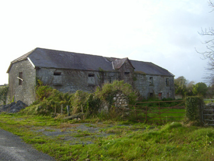 CregaclareFarmyard complex · 538 yd
Explorer Tom Cregaclare in Cregaclare Demesne has lost its main house but kept all its fancy farm outbuildings. The craftsmanship is…
 Standing stone in RooghaunStanding stone · 898 yd
Explorer Tom This standing stone would tell its younger self to stop being so rigid. It’s been eroded by time and probably a few bad…
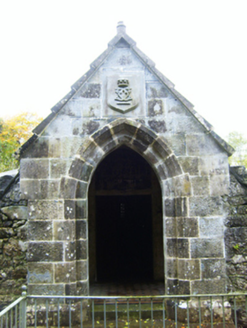 mausoleum1269 yd
Explorer Tom Mausoleum in Cregaclare Demesne was built after two lads bet a bar tab on who could out-live their family. It’s all cut…
 Fairy fort / earthen ringfort in Furzypark (dunkellin By.)Fairy fort / earthen ringfort · 1336 yd
Explorer Tom Fairy fort / earthen ringfort in Furzypark used to have an underground passage, which is basically a secret room where…
 Ardrahan GAA pitchGAA ground · 1685 yd
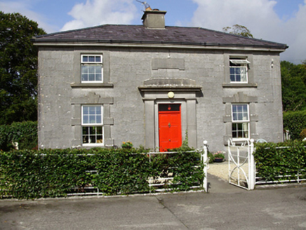 Castle TaylorSteward's house · 1.0 mi
Explorer Tom Castle Taylor’s steward's house in Castletaylor South took the long way home and ended up looking like a proper…
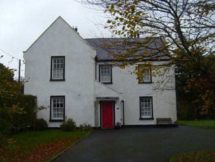 The Old DispensaryHouse · 1.1 mi
Explorer Tom The Old Dispensary gave up sugar for Lent, which is ironic because it used to hand out medicine to people who ate too…
 Castle (in ruins)Castle, Anglo-Norman masonry castle · 1.1 mi
Explorer Tom Castle in Ardrahan North, County Galway is probably where the rabbits hold their council meetings every Tuesday night.…
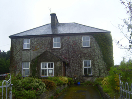 FerndaleSchool · 1.1 mi
Explorer Tom Ferndale in Ardrahan North is a former school that reviews its own visitors with the harshness of a headmaster who lost…
 CastleCastle, tower house · 1.1 mi
Explorer Tom Castle in Castletaylor South is gone but not forgotten, which is annoying. A fox took charge of the place around 1800…
 Labane Catholic GraveyardGraveyard · 1.6 mi
Explorer Tom Labane Catholic Graveyard keeps getting picked on by the wind because it stands too close to a particularly cheeky oak…
More archaeology and monuments in County Galway · All of County Galway

What do you know about this place?Tap to add a comment or ask a question