
Places near here
Photo credits
- DeeEmm, Geograph · CC BY-SA 2.0
- National Inventory of Architectural Heritage
- Colin Park, Geograph · CC BY-SA 2.0
- Boomur, Wikimedia Commons · CC BY-SA 3.0
- Rryswny, Wikimedia Commons · CC BY-SA 4.0
- Wanfried-Dublin, Wikimedia Commons · CC BY 4.0
- Ian Capper, Geograph · CC BY-SA 2.0
- Joseph McGinley, Geograph · CC BY-SA 2.0
- Didier Descouens, Wikimedia Commons · CC BY-SA 4.0
- Willow, Wikimedia Commons · CC BY 2.5
- Mike Parker, Wikimedia Commons · CC BY-SA 2.0
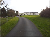 Cloghballymore HouseHouse, 18th/19th century · 1.1 mi
Explorer Tom Cloghballymore House has a rivalry with a more famous castle down the road and loses every time. It just shrugs it off and keeps standing tall, ignoring all the attention its neighbor gets. Go at sunset and thank me later for the tip.
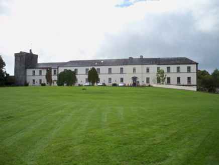 Cloghballymore HouseCountry house · 1.1 mi
Explorer Tom Cloghballymore House was once a towerhouse, then an African Missions College, now just a very confused country house. Someone wrote a bad poem about its irregular front elevation in 1920. Great spot to propose to your wallet.
 Dungory Castle (in ruins)Castle, tower house · 1.5 mi
Explorer Tom Dungory Castle in Dungory West is just a name on a map right now, so let's pretend the local sheep are running the whole show. I heard they vote on who gets to stand guard every Tuesday evening. Ideal stop for a big stretch and a bigger yawn.
 Dunguaire CastleCastle · 1.5 mi
 St. Sorneys WellHoly well · 2.8 mi
Explorer Tom St. Sorneys Well has seven steps and a tradition of patterns that sound like a very organized gym routine. It bragged about surviving storms, but mostly it’s just there for the votive offerings. A handy spot to stretch your legs and your imagination.
 Drumacoo Monastic SiteHeritage attraction · 2.8 mi
 Wedge tomb in Doorus DemesneWedge tomb · 3.0 mi
Explorer Tom Wedge tomb in Doorus Demesne has a chamber formed of uprights. It would buy a yacht with a lotto win and park it on the roof. Pick a stone, any stone, and invent its biography.
 Traught BeachBeach / strand · 3.7 mi
 Island EddyIsland · 4.4 mi
 Hawthorn5.0 mi
 European ash5.0 mi
 Coole ParkVisitor attraction · 5.2 mi
More archaeology and monuments in County Galway · All of County Galway

What do you know about this place?Tap to add a comment or ask a question